

Volcanic Loop Highway: A 5-Day Road Trip Around Tongariro’s Volcanoes
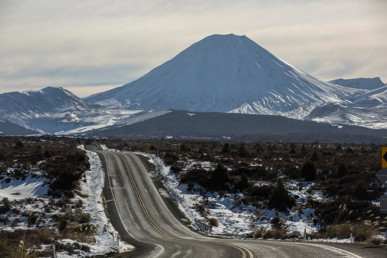
The Volcanic Loop Highway circles three active volcanoes in the middle of the North Island. It starts and ends in the river town of Tūrangi and follows State Highways 47, 4, 49 and 1. Along the way you pass alpine lakes, ski fields, a famous day walk and the bare plains of the Desert Road. The full loop is only about 170 km long. However, there is so much to see that five days is the right amount of time to enjoy it properly.
What Is the Volcanic Loop Highway?
The Volcanic Loop Highway is a themed touring route that wraps around Tongariro National Park. Mount Ruapehu, Mount Ngauruhoe and Mount Tongariro sit at the centre of the loop. All three are active volcanoes, and you will see them from almost every part of the drive on a clear day.
Tongariro National Park has a special place in New Zealand history. It was the first national park in the country. In 1887 the paramount chief of Ngāti Tūwharetoa, Te Heuheu Tukino IV, gifted the sacred peaks to the nation so they would be protected. The park is now a dual World Heritage Area. It is listed for both its natural features and its cultural importance to Māori.
The loop also works well as an add-on to the Thermal Explorer Highway. Many travellers drive down from Lake Taupō, complete the circuit and then continue south or west.
Volcanic Loop Highway Map
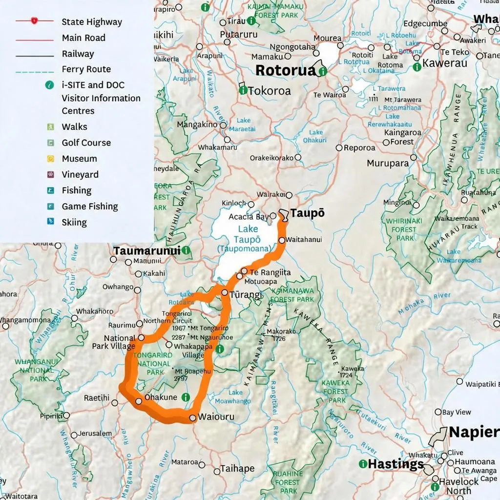
Use the map to see how the loop fits together before you set off. It shows the full 170 km circuit around Tongariro National Park, starting and ending in Tūrangi, with the main stops in driving order.
Planning Your Volcanic Loop Highway Road Trip
The roads on this route are sealed and well used. Even so, the weather on the Central Plateau changes quickly and the area sits at high altitude. Our guide to driving in New Zealand covers the basics. Also keep these points in mind before you go:
- Check road conditions. Snow and ice can close parts of the route in winter, especially the Desert Road.
- Pack warm layers. Even in summer it can be cold and windy near the mountains.
- Book activities early. Shuttles for the Tongariro Alpine Crossing fill up fast in peak season.
- Fuel up in towns. Tūrangi, National Park Village, Ohakune and Waiouru all have fuel, but there is nothing on the Desert Road itself.
- Respect the land. The mountains are sacred to local iwi, so stay on marked tracks and leave no trace.
Day 1: Tūrangi and the Tongariro River
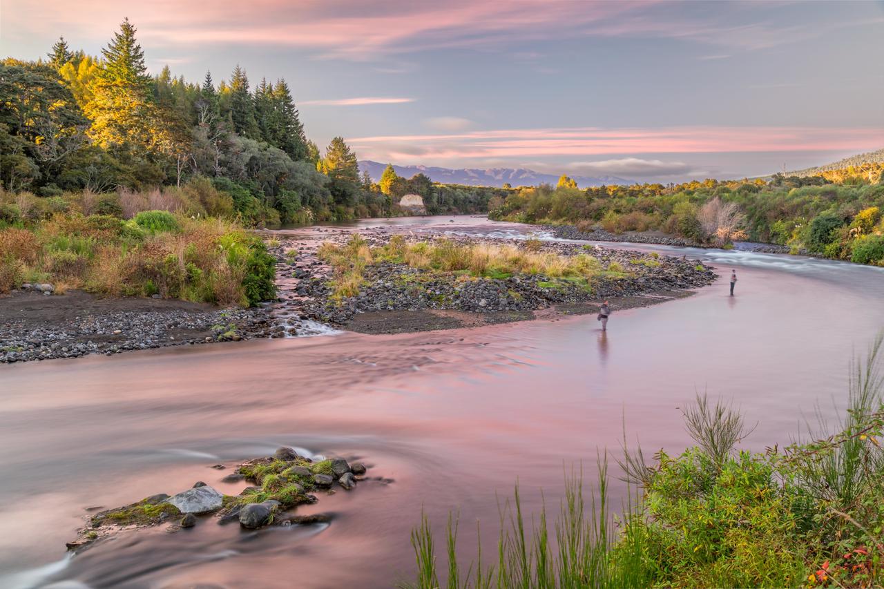
Tūrangi sits near the southern end of Lake Taupō and is the starting point for the loop. The town is best known for trout fishing on the Tongariro River. If you do not fish, try the Tongariro River Trail. This easy walking and cycling path follows the river through native bush. You can also visit the Tongariro National Trout Centre just south of town to learn how the fishery works.
Day 2: Lake Rotopounamu, Whakapapa and Mount Ruapehu
Head west on State Highway 47 towards Tongariro National Park. Your first stop is Lake Rotopounamu, a quiet bush-fringed lake at the foot of Mount Pihanga. An easy loop track of about 5 km circles the lake and takes around two hours.
Next, turn onto State Highway 48 and drive up to Whakapapa Village on the slopes of Mount Ruapehu. The village is home to the historic Chateau Tongariro hotel. The building has been closed since 2023 while a new operator is found, but it still makes a striking photo stop. From the village, the Taranaki Falls walk is one of the best short hikes in the park. The loop takes about two hours and leads to a 20 m waterfall tumbling over an old lava flow.
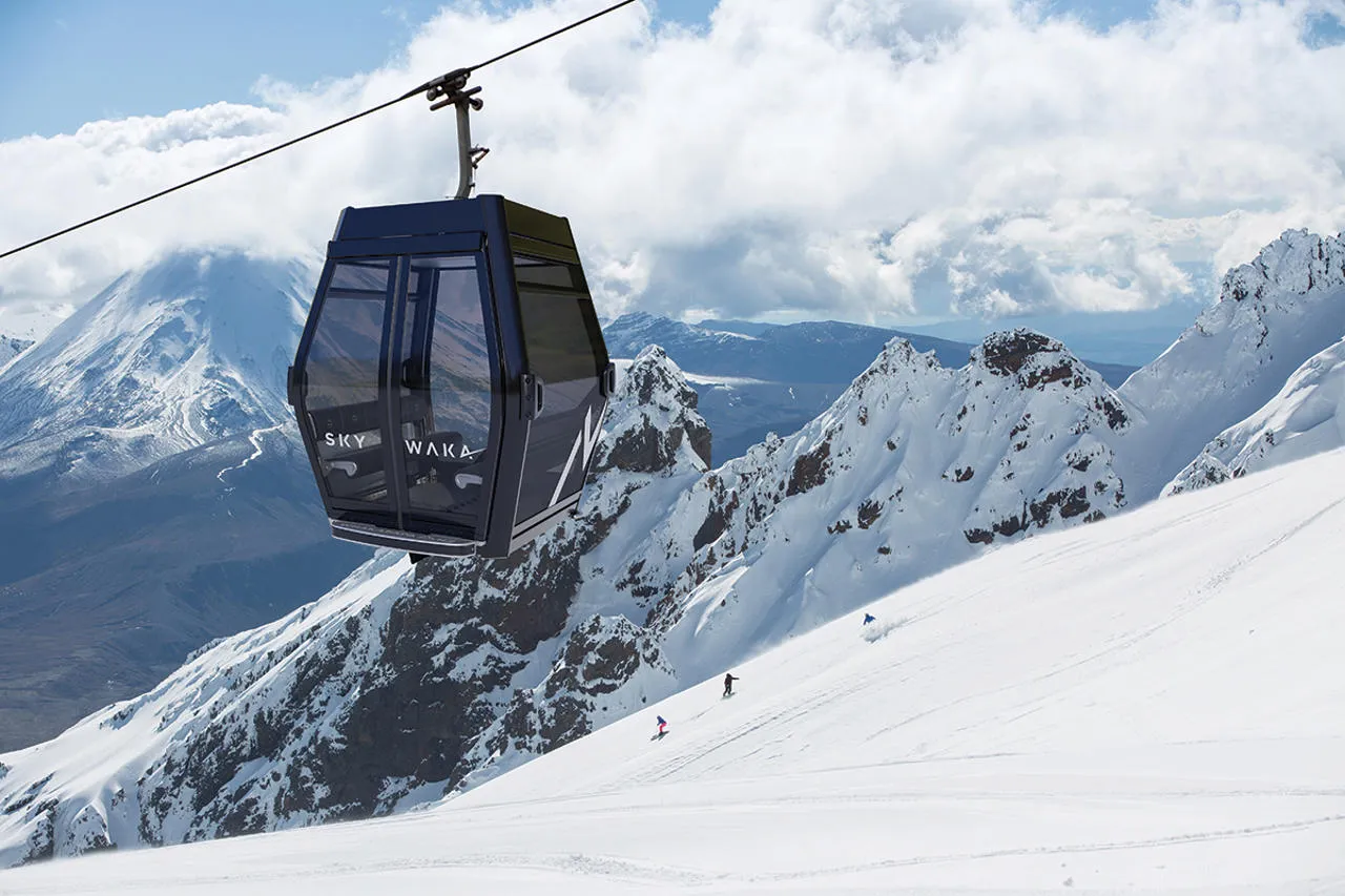
In the afternoon, ride the Sky Waka gondola from the Whakapapa Ski Area. The 1.8 km ride climbs high onto Mount Ruapehu and ends at Knoll Ridge Chalet. From the top you can enjoy lunch or a coffee with wide views across the volcanic plateau. Stay the night in Whakapapa or nearby National Park Village.
Day 3: The Tongariro Alpine Crossing
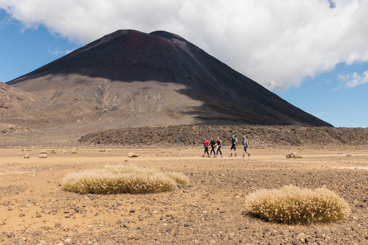
Day three is for one of the best things to do in Tongariro National Park. The Tongariro Alpine Crossing is a 19.4 km one-way walk between Mount Tongariro and Mount Ngauruhoe. It passes old lava flows, steam vents, the Red Crater and the bright Emerald Lakes. Most people take seven to eight hours in summer. Along the way you walk beside Mount Ngauruhoe, which played Mount Doom in The Lord of the Rings. If you have more time, the longer Tongariro Northern Circuit is one of the country’s Great Walks.
There is no visitor parking at the Mangatepopo car park in summer. Book a shuttle from National Park Village, Tūrangi or Ohakune instead. Start early and check the mountain forecast the night before. Fires in late 2025 burned parts of the area near the start of the track. Expect some blackened land and stay on the marked path to help the area recover. In winter the crossing becomes an alpine trip that needs ice skills, so most visitors go with a guide.
Day 4: Ohakune and the Southern Slopes
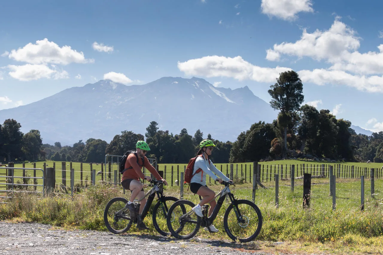
Drive south on State Highway 4 and then State Highway 49 to reach Ohakune. This small mountain town sits on the southern side of Mount Ruapehu. It is the base for the Tūroa ski area in winter and a cycling hub in summer. The Ruapehu region has plenty of guided tours if you want a local to show you around.
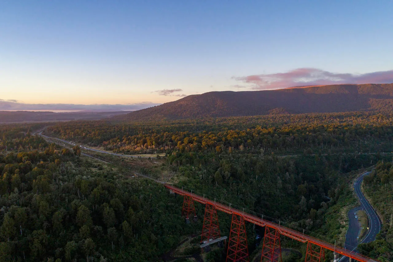
Ohakune is famous for growing carrots. You can take a photo with the giant carrot sculpture at the edge of town. For something more active, ride or walk part of the Ohakune Old Coach Road. This historic trail follows an old coach route and crosses the tall Hapuawhenua Viaduct, a restored railway bridge. Later in the day, drive up Ohakune Mountain Road to see Mangawhero Falls.
Day 5: Waiouru and the Desert Road

From Ohakune, head east on State Highway 49 to Waiouru. This is New Zealand’s main army town, and it is home to the National Army Museum Te Mata Toa. The museum tells the story of New Zealand soldiers from the New Zealand Wars to modern times. Allow at least two hours here.
Then turn north onto State Highway 1 for the final and most dramatic part of the Volcanic Loop Highway. The Desert Road runs for about 60 km from Waiouru back to Tūrangi. It crosses the Rangipo Desert, a wide plain of tussock and grey volcanic soil. The area gets plenty of rain, but poor soils and drying winds stop most plants from growing. The road also reaches 1,074 m at its summit, the highest point on the state highway network.
Much of the land on either side is used for army training. There are no official lookouts. However, there are safe pull-over bays where you can stop and photograph Mount Ruapehu rising above the desert. Arrive back in Tūrangi in time for dinner and a well-earned rest.
Things to Do in Tongariro National Park
If you want a quick list, these are the top things to do in Tongariro National Park and along the loop:
- Hike the Tongariro Alpine Crossing
- Walk to Taranaki Falls from Whakapapa Village
- Ride the Sky Waka gondola on Mount Ruapehu
- Circle Lake Rotopounamu on an easy bush walk
- Cycle the Ohakune Old Coach Road
- Drive the Desert Road for wide volcanic views
- Ski at Whakapapa or Tūroa in winter
Best Time to Drive the Volcanic Loop Highway
Summer and early autumn, from December to April, are the best months for walking. The Tongariro Alpine Crossing is at its easiest in this period, and the days are long. Winter runs from June to October. Snow covers the mountains and the area becomes the busiest ski region in the North Island. See our guide to the best New Zealand ski resorts to compare Whakapapa and Tūroa. The drive is still beautiful in winter. However, you need to watch for road closures and carry chains if you plan to drive up the ski field roads.
Final Thoughts
The Volcanic Loop Highway packs a lot into a short distance. In five days you can walk past steaming craters, ride a gondola up an active volcano and cross a desert. The loop suits hikers, skiers, families and anyone who enjoys big mountain views. Pack warm clothes, book your Tongariro Alpine Crossing shuttle early and give yourself time to slow down. Your Volcanic Loop Highway road trip will show you a side of New Zealand that few other drives can match.
Frequently Asked Questions
How long does it take to drive the Volcanic Loop Highway?
The loop is about 170 km and takes around two and a half hours without stops. Most travellers spread it over four or five days to enjoy the walks and attractions.
Is the Desert Road open in winter?
Yes, the Desert Road stays open for most of the winter. However, heavy snow and ice can close it for hours or even days at a time. Check the NZ Transport Agency Waka Kotahi journey planner before you set off.
Why is it called the Desert Road?
The road crosses the Rangipo Desert. This area is not a true desert because it gets a lot of rain. It looks like one because the volcanic soils are poor and strong winds dry out the land.
Do you need to book the Tongariro Alpine Crossing?
You do not need a permit to walk it. However, you will need to book a shuttle in summer because there is no visitor parking at the Mangatepopo start.
Can you see the volcanoes from the road?
Yes. On a clear day you can see Mount Ruapehu, Mount Ngauruhoe and Mount Tongariro from many parts of the loop. The Desert Road and State Highway 47 give some of the best views.
Is Tongariro National Park a World Heritage Site?
Yes. Tongariro National Park holds dual World Heritage status for its natural landscape and its cultural importance to Māori.