
DOC Campsites in New Zealand: Where Your Road Trip Gets Good
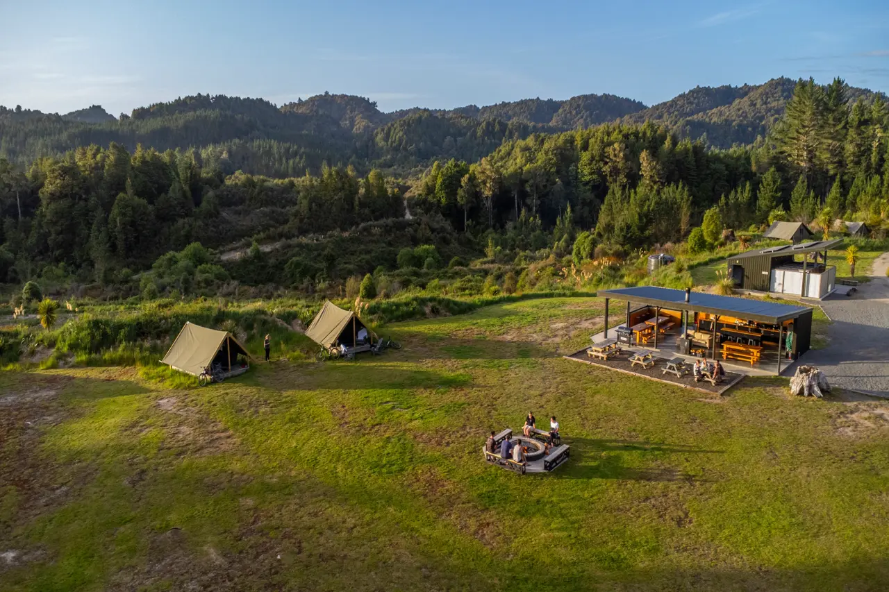
Picture waking up beside a glacial river with nobody else in sight. That’s the pitch. DOC campsites in New Zealand sit on conservation land, often right beside the best scenery on your route, and they cost a fraction of what a motel room does.
This guide covers 122 of them, drawn from the Department of Conservation’s campsite maps for campervans and other vehicles. Each numbered entry is one listing, bar the Kauaeranga Valley in the Coromandel, which bundles a string of riverside sites into a single stop. We’ve sorted everything by region, north to south, so you can drop a campsite into any route you’re planning.
Doing the whole country? Start with our New Zealand motorhome holidays page, then pick a ready-made route like the 13-day campervan trip from Auckland to Christchurch or the 14-day motorhome itinerary. Need wheels first? Our campervan rental guide explains the options.
Download the New Zealand DOC Campsites Maps
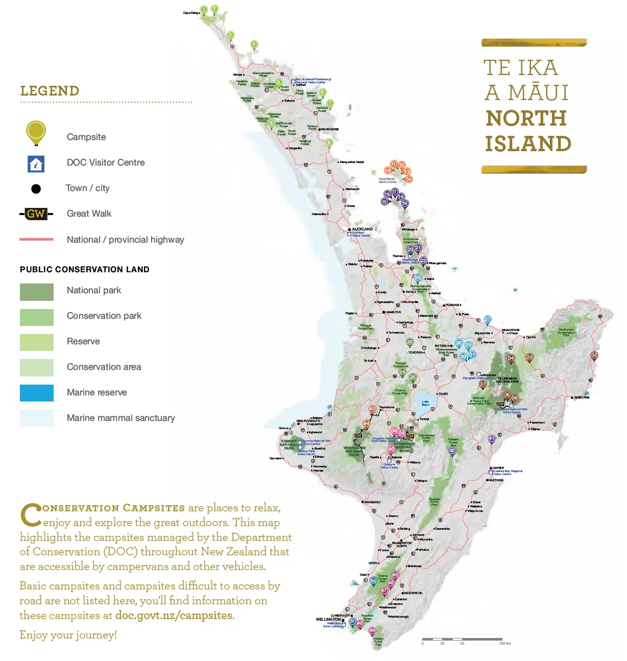
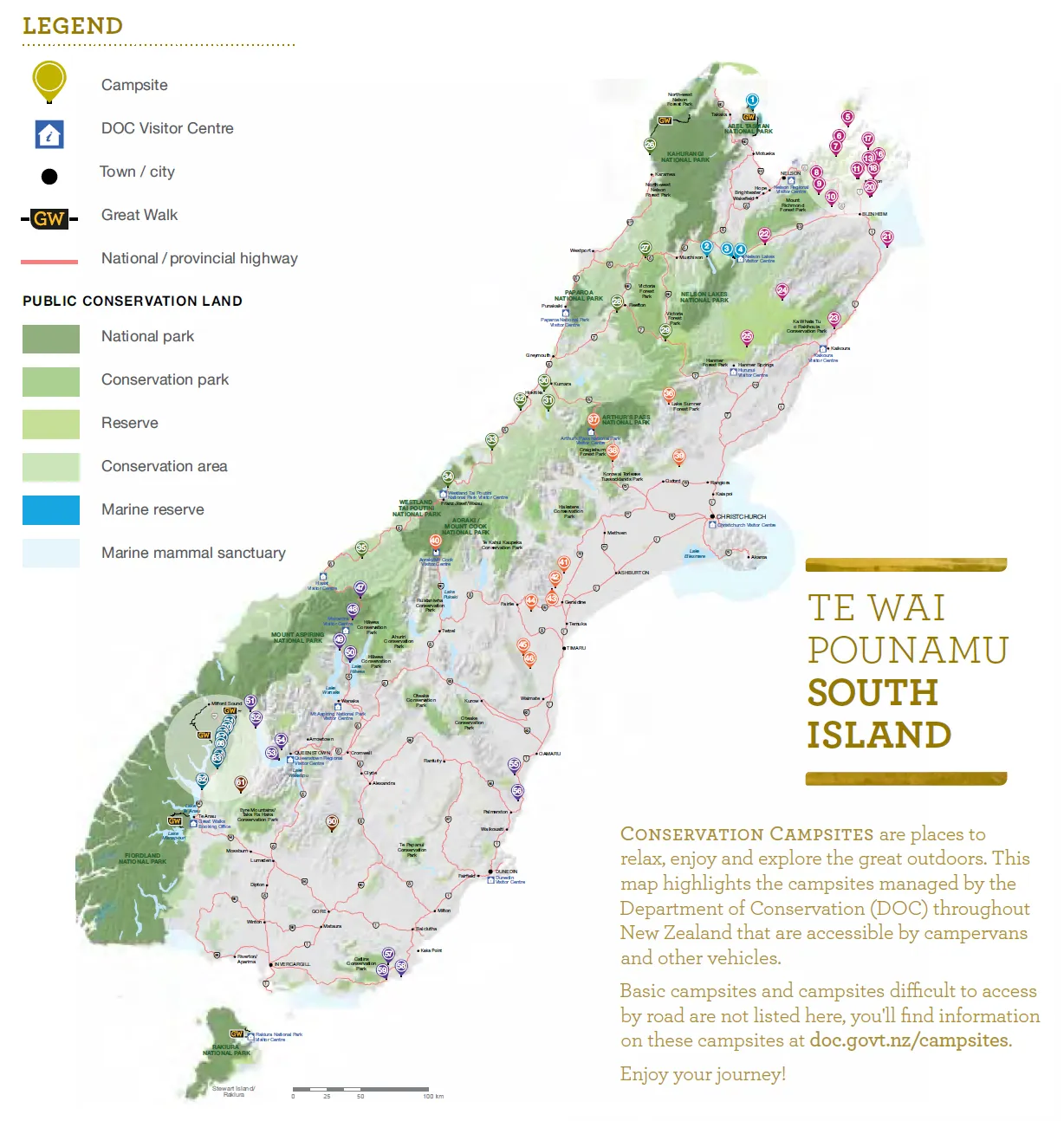
Signal fades fast out here, so save the maps before you leave. Grab the New Zealand campsites North Island map and the New Zealand campsites South Island map. Both are free PDFs. The numbers in this article follow the order of the regions below, not the numbers printed on the maps.
One caveat. The details here come from DOC’s published campsite listings, and things change. Seasons shift, roads close after storms and fees rise. Check the campsite’s page on DOC’s campsite search before you drive out.
How DOC Campsites Work: Fees, Categories and the Pass
DOC sorts its campsites by how much comes with them, and the fee follows. Older maps, including the brochure behind our downloads, also use a “scenic” label. DOC’s current fee page lists the categories below. Prices vary by site and season, so treat these as ranges.
| Campsite type | What you get | Adult per night | Child (5–17) per night |
|---|---|---|---|
| Serviced | Flush toilets, tap water, kitchen bench, hot showers, rubbish collection, road access for all vehicles | $25 (unpowered) | $12.50 (unpowered) |
| Standard | Toilets, water from a tap, stream or lake, vehicle or boat access | $10–$20 | $5–$10 |
| Basic | Very limited facilities, so bring everything you need | Free | Free |
| Backcountry | Toilets and a water supply, sometimes from a stream | Varies | Varies |
Infants aged 0–4 stay free. Prices are in NZ dollars.
Is the DOC Campsite Pass worth it?
The Campsite Pass costs $295 per adult and $147.50 per child for a year. You can use it for up to seven nights in a 30-day period at a single campsite, and powered sites carry a $3 per person, per night charge. Book bookable campsites before you arrive. Do the sums first: at $20 a night, the adult pass breaks even after roughly 15 nights. A long trip through the South Island could clear that. A fortnight probably won’t.
Do you need to book?
Sometimes. Many DOC campsites take online bookings, while others run first come, first served. Summer is the squeeze. Book well ahead for December to February and public holidays, particularly at coastal sites and anywhere near a national park. Not sure when to go? Our best time to visit New Zealand guide and weather and climate page help you choose.
Taking a Motorhome to DOC Campsites: What to Check
Most DOC campsites welcome campervans and motorhomes. Not all suit them. Roads to the best spots are often gravel, narrow or winding, and a few have stream fords. Before you commit, run through this short list:
- Vehicle length. Some sites flag size limits. Lake Okareka isn’t suitable for vehicles over 6 m, and Molesworth’s Acheron Road rules out anything over 7 m.
- Gravel and insurance. Check your rental agreement before driving unsealed roads. Plenty of policies restrict them.
- Seasons and closures. Several campsites open only in summer, and floods or fires can shut roads.
- Water and rubbish. Some sites have no reliable drinking water. Carry your own and take your rubbish with you.
- Freshwater pests and kauri. Check, clean, dry your gear around rivers and lakes, and clean footwear and tyres near kauri.
New to driving here? Read our driving in New Zealand guide first. You can also plot your route on the route planner and travel map.
North Island DOC Campsites (1–51)
The North Island has 51 campsites on the map, from Cape Reinga to the Wellington coast. For more ideas on what to see along the way, browse our best North Island tourist attractions.
D
DOC Campsites in Northland
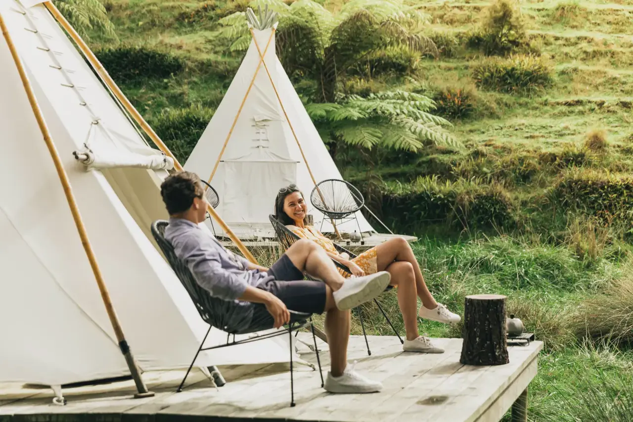
Northland is a long drive, and the last stretch to Cape Reinga is the reward. Pair these campsites with our Northland and Bay of Islands guide and you’ve got a proper northern loop. Kauri forest, empty beaches, gravel roads. All of it.
1. Tapotupotu
The northernmost campsite on the map. It sits at the end of Tapotupotu Road, about 3 km south of Cape Reinga, with a beach for swimming, snorkelling and surfing. Walkers can pick up the Te Paki Coastal Track from here. The road is gravel with a few steep pitches, so ease your motorhome down.
2. Kapowairua (Spirits Bay)
Sixteen kilometres of gravel stand between you and this one. Worth it. Kapowairua tucks in between hills and a beach that’s only a five-minute walk away, up on the Aupouri Peninsula north of Kaitaia. Follow the signs from Waitiki Landing off SH1.
3. Rarawa
Trees at your back, white sand out front. Rarawa sits 3 km north of Ngataki off SH1, and the final 4 km are gravel. Surfers and anglers love it, but the beach can turn dangerous, so check conditions before anyone paddles.
4. Maitai Bay
Out on the Karikari Peninsula, Maitai Bay spreads across sheltered, private-feeling sites near the coast. It’s big, too. You’ll find it about 25 km southeast of Kaitaia, and the final 2 km into the campsite are gravel.
5. Puketi
Kauri forest camping, with a decent shot at hearing kiwi and spotting short-tailed bats after dark. A hut and a couple of small cabins share the site, which helps if the rain sets in. Turn off SH10 into Pungaere Road just north of Waipapa, then brace for 16 km of gravel.
6. Puriri Bay
Puriri Bay looks out over the mouth of Whangaruru Harbour. Swim, boat, walk. The road in is sealed, but DOC’s map warned that vehicle access shuts from May to October, so confirm the season before you point the wheels north.
7. Otamure
Beachfront, with big pōhutukawa for shade (they flare red around Christmas, which is a pretty good reason to visit). Leave SH1 past Hikurangi, take Whananaki North Road and keep going until you’re about 4 km beyond the Whananaki shop. Sealed all the way.
8. Uretiti
One of the biggest campsites on this list. It’s tucked behind the dunes at Uretiti Beach, signposted straight off SH1 about 5 km north of Waipu. Walk the coastal track or poke around the Waipu Caves. Sealed access makes it a handy first or last night out of Auckland.
9. Trounson Kauri Park
Native forest doesn’t get much better than this. The campsite sits at the edge of Trounson Kauri Park, 40 km north of Dargaville off SH12. It’s sealed from the south and gravel from the north. Follow the kauri dieback drill: stay on the tracks and clean your boots and tyres.
DOC Campsites on Great Barrier Island (Aotea)
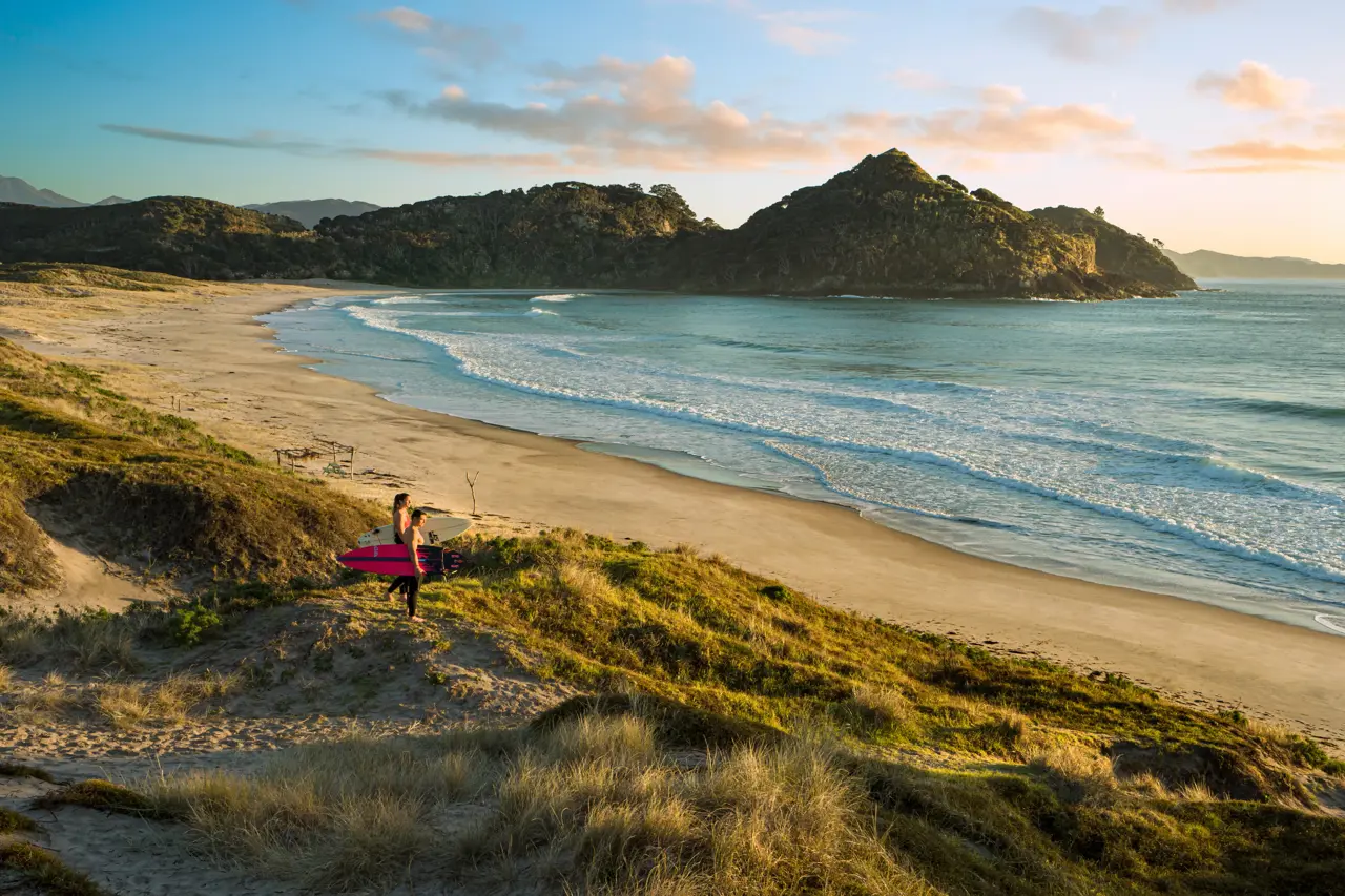
Great Barrier is a different kind of road trip. You’ll need a ferry or flight, and your rental company may not let its vehicle make the crossing, so check before you commit. Our Auckland day tours page covers the mainland side of the trip.
10. Akapoua Bay
A sheltered bay under pōhutukawa on the west coast, near Port Fitzroy. Fishing, swimming and kayaking all start from the shore. Boat access is good, too.
11. Whangapoua
Up on the north coast, this campsite hugs the edge of the Whangapoua estuary and a surf beach. It’s close to Okiwi Airfield. Calm water on one side, rolling surf on the other. Take your pick.
12. Harataonga
Camp between two streams under mature trees on the east coast, with views over Overton Beach to Rakitu Island. Reach it along Port Fitzroy Road to Kaitoke. Quiet. Properly quiet.
13. Awana Beach
Grassy sites sit beside the Awana estuary, which suits kids. The surf break next door is powerful, so it’s not just a paddling beach. Pack mosquito repellent. You’ll want it.
14. Medlands Beach
A sheltered campsite at the south end of Medlands Beach, overlooking a tidal stream. Surfers hit the beach while families stick to the safe estuary water. Easy to like.
DOC Campsites in the Coromandel
The Coromandel gets slammed over Christmas, and DOC’s map suggests booking northern campsites as early as October. Weather swings fast here, and streams can flood in a hurry. Our Coromandel Peninsula guide has plenty to fill the days between camps.
15. Fantail Bay
Peaceful pōhutukawa shade, 50 km north of Coromandel town. A track with big views climbs to the bushline. Gravel starts at Colville and keeps going, so allow plenty of time.
16. Port Jackson
The campsite sits beside the beach at the northern tip of the peninsula. Coastal views everywhere you look. It’s a Christmas favourite, so book early. Gravel from Colville.
17. Fletcher Bay
Beachfront and farm-flanked, at the very end of the road about 64 km north of Coromandel town. Water sports are the draw. Gravel all the way from Colville.
18. Stony Bay
Five hectares of space beside the coast, which makes it one of the roomier choices up north. Fishing and diving spots sit close by. Turn right at Whangaahei Junction, follow Port Charles Road to Stony Bay Road, and keep going to the end.
19. Waikawau Bay
A sweeping sandy beach and room for a crowd. NZ dotterel and variable oystercatcher breed north of the campsite, so give them space. From Whangaahei Junction, turn right into Port Charles Road, then right again into Waikawau Beach Road and follow it 5 km.
20. Kauaeranga Valley
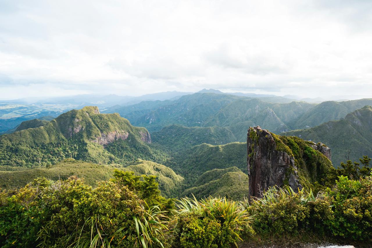
Not one campsite. A whole string of them. Along the gravel Kauaeranga Valley Road, 14 km from Thames to the Visitor Centre, you’ll find riverside sites including Kahikatea, Shag Stream, Hotoritori, Whangaiterenga, Booms Flat, Catleys, Wainora, Totara Flat and Trestle View. Kahikatea is for self-contained vehicles only (no tents) and has sites big enough for buses. Hotoritori is where mountain biking and horse tracks begin. Wainora starts the Cookson Kauri Walk. Trestle View sits close to the tracks up to the Pinnacles. Several sites only open from Labour Weekend to the end of April, and DOC’s map said to pay at the Visitor Centre. This entry counts as one in our 122.
21. Broken Hills
Old gold-mining country beside the Tairua River. Swim, canoe, fish, or wander the historic workings. From Hikuai on SH25, follow Puketui Valley Road to the end. Gravel.
22. Wentworth
Once a busy gold settlement, now a remote but comfortable campsite near Wentworth Falls and old mine sites. Turn off SH25 about 7 km south of Whangamata. The last 5 km are gravel with a small stream ford, so check river levels after rain.
DOC Campsites in Waikato
Pureora Forest is the star here. If you’re working north to south, it makes a lovely detour from SH30, and our Waikato and Waitomo page will help you build a day around it.
23. Arohena
Fishing and water sports on the western shore of Lake Arapuni, right on the Waikato River. The last kilometre is winding gravel with tight corners, which isn’t ideal for large motorhomes.
24. Ngaherenga
Pureora Forest is famous for towering podocarps, and this campsite sits right beside them. Look for kākā, kākāriki, robins and short-tailed bats in the trees. It’s off SH30 near Pureora Field Base. Gravel access.
25. Kakaho
A private-feeling forest stop with a walk up to a stunning lookout. Reach it via Link Road from Pureora Field Base or Kakaho Road from SH32. Gravel.
DOC Campsites in the Bay of Plenty and Rotorua Lakes

Lakes, rivers and a coastal wildlife refuge, all within a short drive of geothermal country. Build a few days around the Bay of Plenty and Rotorua attractions pages and you’ve got a full circuit.
26. Dickey Flat
Beside the Waitawheta River, which trout anglers and swimmers both rate. Get there via Waitawheta Road, Kennedy Road and Dickey Flat Road. Gravel.
27. Rerewhakaaitu – Brett Road
A lakeside camp on Lake Rerewhakaaitu, with water birds, fishing, swimming and walks close by. Take Rerewhakaaitu Road off SH38, then follow Brett Road. Sealed all the way.
28. Rerewhakaaitu – Ash Pit Road
Same lake, bigger campsite. You’ll cover 2 km of gravel on Ash Pit Road to reach it, but the water birds and fishing make it a fair trade.
29. Matata
A family-friendly coastal camp next to the Matata wildlife refuge, with excellent fishing and swimming. You cross a short causeway from Arawa Street to get in, and the surface is gravel.
30. Lake Okareka
Lakeside, scenic and just 15 minutes from Rotorua. Swim or fish. It’s a small site, and DOC’s map said it isn’t suitable for vehicles over 6 m, so bigger motorhomes should look elsewhere. The road to the campsite is sealed.
31. Lake Tarawera Outlet
Big, attractive and lakeside, with trout fishing and water sports. Getting there takes some planning. Drive in through private forestry roads from Kawerau with a permit from the Kawerau Information Centre, or arrive by boat.
DOC Campsites on the East Coast and in Te Urewera
Remote roads, big skies and a lake few visitors reach. Gisborne and the East Cape reward patient drivers, and our Gisborne and Eastland page shows what’s nearby.
32. Anaura Bay
Eighty-five kilometres north of Gisborne on SH35, between Tolaga Bay and Tokomaru Bay. Beach, stream, forest and coastal bush all in one frame. The final 4 km are gravel. DOC’s map said toilets weren’t provided, so bring a chemical toilet, and it listed the season as Labour Weekend to Easter.
33. Manganuku
Camp next to one of the few surviving historic Howe truss bridges, beside SH2 in the Waioeka Gorge south of Ōpōtiki. Good river fishing. Sealed access.
34. Omahuru (Ogilvies)
Camp, swim, fish or just sit by the river. Pack binoculars for birdwatching. Eighteen kilometres of gravel off SH2 get you there.
35. Mokau Landing
A large grassy site between native rainforest and Lake Waikaremoana, 1.5 km from Mokau Falls. You’ll drive about 10 km around the lake from Aniwaniwa on narrow, winding gravel, so take care in a big rig.
36. Waikaremoana Holiday Park
Camp right by the lake. Visit the 1000-year-old rātā tree, Aniwaniwa and Papakorito Falls, and the Te Urewera Visitor Centre. Chalets and cabins are available too. The road from Wairoa is narrow with gravel sections, and the drive from Rotorua after Murupara takes about two hours of winding gravel. Book ahead.
37. Mangamate
An easy-to-reach site beside the Whirinaki River, with rimu and tōtara in the nearby forest. Follow Te Whaiti Road from Murupara; the last 1 km is gravel. There are some wheelchair facilities.
DOC Campsites Around Tongariro and Ruapehu
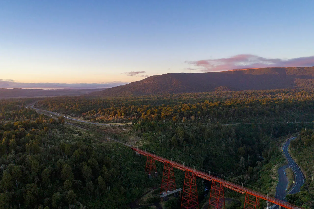
Three campsites, three mountain bases. Add a day to the Great Walks list or browse the Ruapehu activities page before you go. Alpine weather turns quickly, so check in at the Tongariro National Park Visitor Centre before heading up high.
38. Mangahuia
Peaceful, on the edge of Tongariro National Park. Ski, hunt or mountain bike in the neighbouring Tongariro Forest. It’s 6 km east of National Park village off SH47. Gravel.
39. Whakapapa Holiday Park
A forest campsite beside a stream, opposite the Whakapapa Visitor Centre, and a perfect base for the national park. A lodge and cabins are available too. The road to Whakapapa Village is sealed, and the ski fields sit about 6 km away in winter. Book ahead.
40. Mangawhero
In the forest on the flanks of Mt Ruapehu, 2 km from Ohakune along Ohakune Mountain Road. A small site with a little gravel on the way in. A good base for exploring Tongariro National Park.
DOC Campsites in Hawke’s Bay
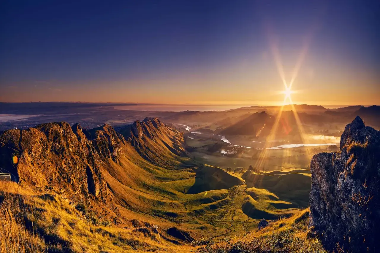
Wine country by day, lakeside or riverside camping by night. See what else the region offers on our Hawke’s Bay activities page.
41. Lake Tutira
At the southern end of the lake, 50 minutes north of Napier, off SH2. Walk to the Table Mountain trig for views across Hawke’s Bay. Toxic algal blooms can hit the lake, so skip the swim if signs say no. Sealed.
42. Kuripapango
Raft the Ngaruroro River or cast a line. The campsite sits beside the sealed Napier–Taihape Road, with 1 km of gravel down to the river.
DOC Campsites in Whanganui National Park
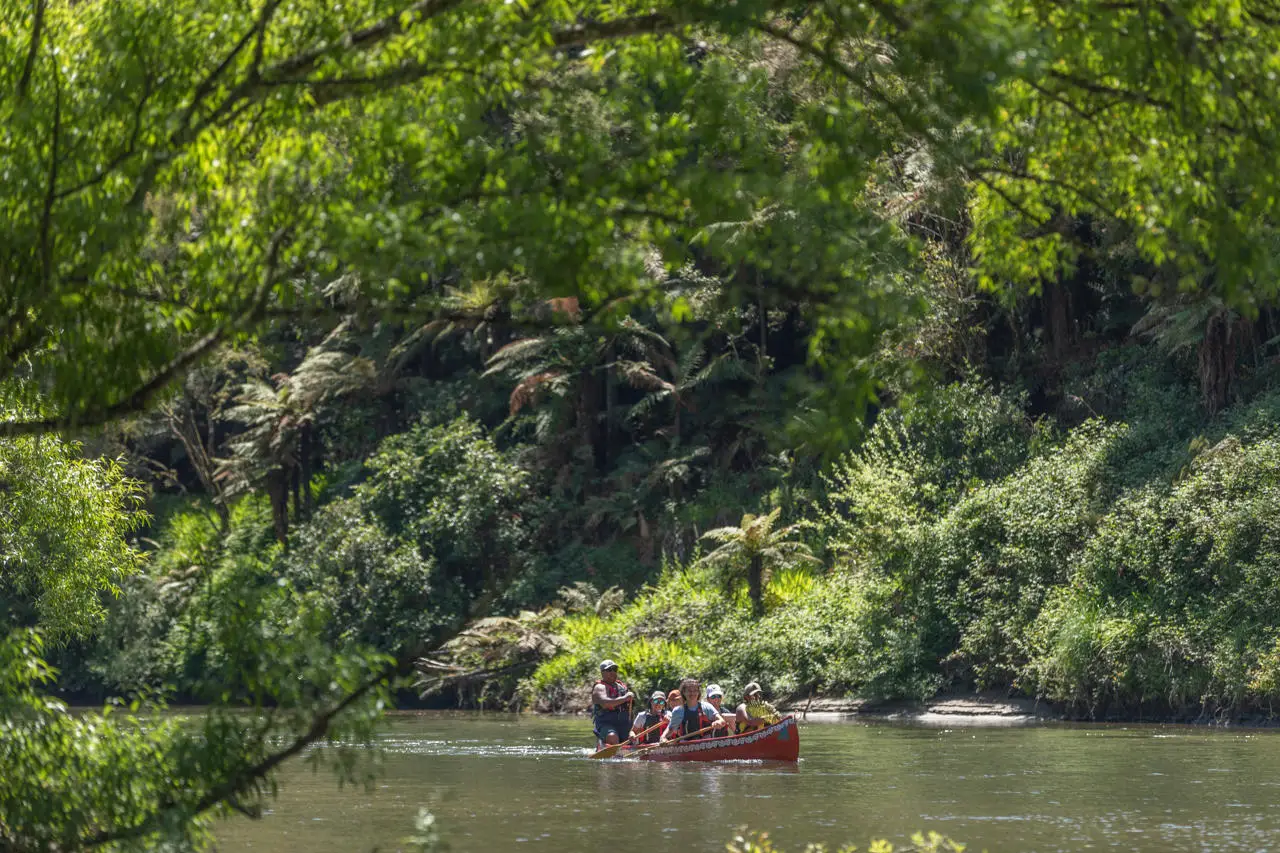
These two campsites double as launch points for the Whanganui Journey. They’re remote and rewarding. Browse the Whanganui and Manawatu page for other stops along the way.
43. Ohinepane
Remote. It’s one of three road access points to the Whanganui Journey Great Walk. Listen for kererū, tūī and fantails by day, and brown kiwi at night. You’ll find it on SH43, 21 km from Taumarunui, with road or river access.
44. Whakahoro
A large, flat, grassy campsite beside the river, and a good start or mid-point stop for the Whanganui Journey. Drive 44 km west of Owhango to the end of Oio Road, off SH4.
DOC Campsites in the Wairarapa
Quiet roads, big gorges and a seal colony. The Wairarapa suits a slow week, and our Wellington and Wairarapa page has ideas for the wet days.
45. Kiriwhakapapa
A lovely family spot beside a creek, near an old logging area and a unique redwood forestry trial. Turn off SH2 about 15 km north of Masterton into Kiriwhakapapa Road and follow it 7 km to the road end. Five of those kilometres are gravel.
46. Holdsworth
One of the biggest campsites on the Wairarapa side of the Tararua Ranges, at the eastern park entrance. Walk, fish and swim nearby. Holdsworth Lodge, which sleeps 28, is available too. Turn off SH2 just south of Masterton; the road is sealed, and the campsite sits about 15 km from the turnoff.
47. Waiohine Gorge
Secluded, at the head of two spectacular gorges above the Waiohine River, 18 km northwest of Greytown. The road is gravel with a stream ford.
48. Corner Creek
A five-minute walk to Palliser Bay. Fishing, surfing, hunting, mountain biking. The catch: 5 km of gravel at the end and two stream fords, and access only works from the eastern side of the Rimutaka Range.
49. Putangirua Pinnacles
Beside Putangirua Stream, halfway between Cape Palliser and Lake Ferry. Walk to the famous pinnacles or drive on to the seal colony. Sealed access. Water isn’t always available, so carry your own.
DOC Campsites Near Wellington and the Kāpiti Coast
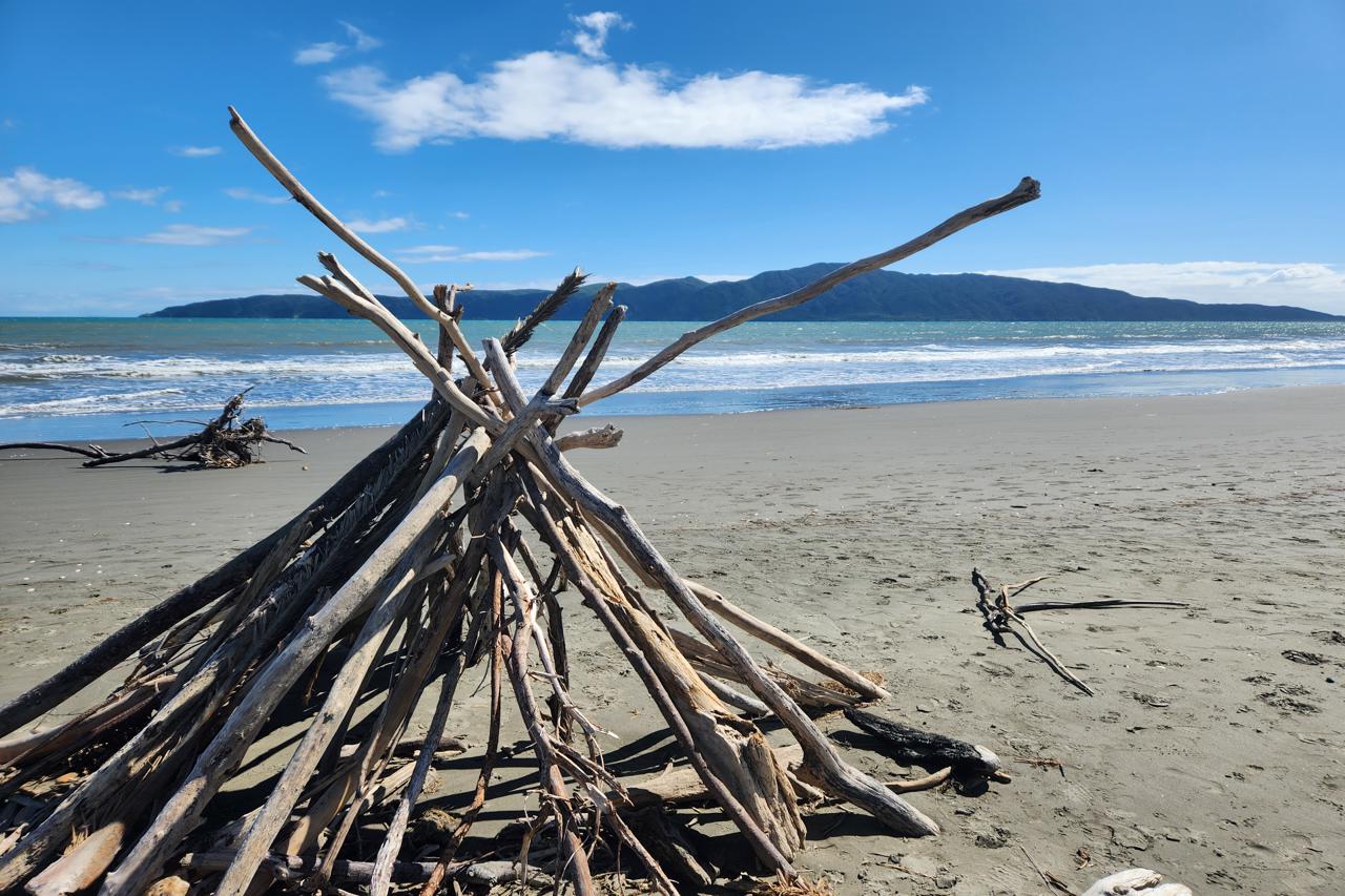
Two campsites within reach of the capital. Handy if you’re timing a last night before the ferry south.
50. Ōtaki Forks
Open river terraces and regenerating bush, 19 km east of Ōtaki township along Ōtaki Gorge Road. Narrow gravel and one stream ford. It’s a big site that handles a crowd.
51. Catchpool
Camp beside Catchpool Stream, close to walks in the Orongorongo Valley in Rimutaka Forest Park. The road crosses a stream ford and has some gravel. The park gates open and close at set times, so check before you arrive.
South Island DOC Campsites (52–122)
The South Island adds 71 more, packed along lakes, passes and the Milford Road. Use our best South Island tourist attractions list to fill the gaps between camps.
DOC Campsites in Nelson Tasman
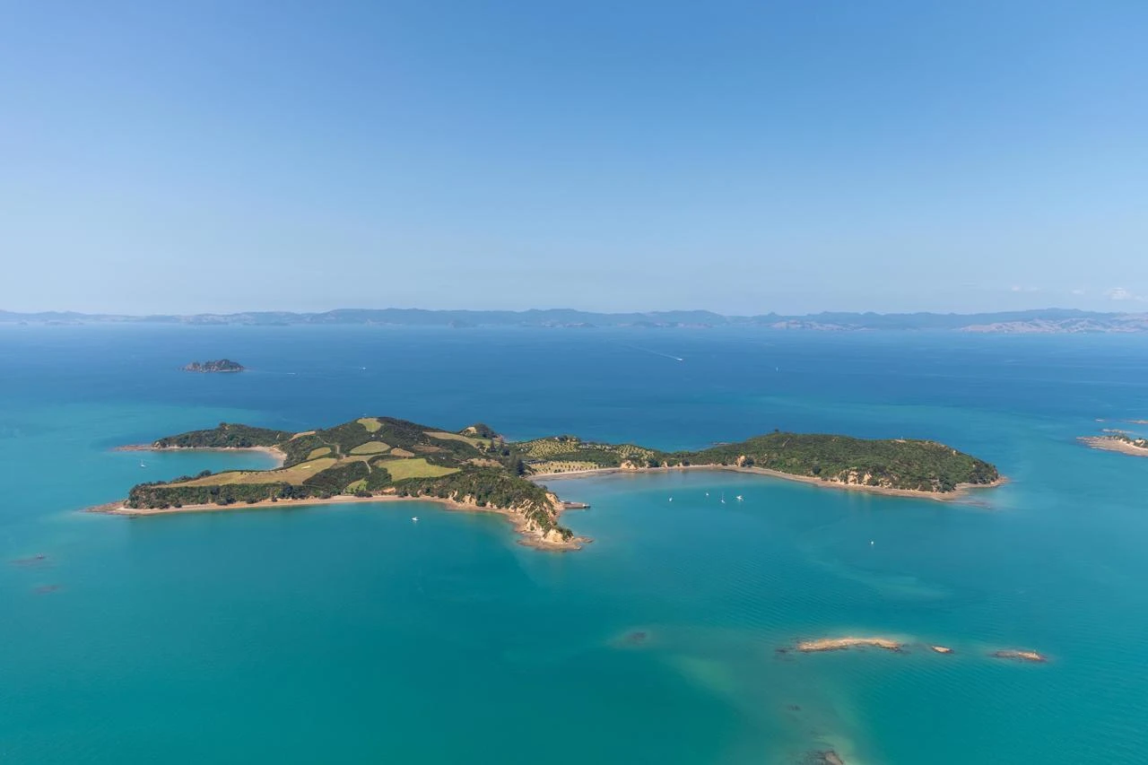
Abel Tasman, Lake Rotoiti and a Murchison backroad. Our Nelson Tasman guide covers what to do once the tent flaps or the motorhome door are open.
52. Totaranui
A huge, popular base on the Abel Tasman coast and a good access point for the Abel Tasman Coast Track. It sits 32 km east of Takaka along Abel Tasman Drive and Totaranui Road. Gravel, or arrive by boat. DOC’s map showed serviced facilities from 10 October to 30 April, and it said booking was essential for December and January.
53. Lake Rotoroa
Native bush, lake views and valley tramps. Take repellent for sandflies. Reach it off SH6 east of Murchison along Gowan Valley Road. Sealed.
54. West Bay
Remote-feeling but easy to reach, just off SH63 on Mt Robert Road west of St Arnaud, beside Lake Rotoiti. Sealed. DOC’s map listed it as open from mid-December to March, plus Easter.
55. Kerr Bay
Beech forest meets Lake Rotoiti, a short stroll from St Arnaud. Sealed road. Showers only run in summer, and DOC’s map said booking was essential from mid-December to the end of April.
DOC Campsites in Marlborough and Molesworth
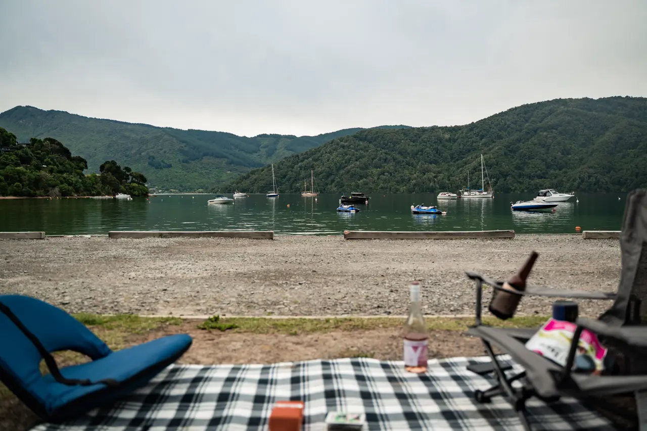
Twenty-one campsites, from sheltered sounds to a high-country farm road. Check the Marlborough activities page and the Kaikōura guide when you’re planning. DOC’s map banned fires at every Marlborough campsite because of the fire risk, and dogs needed a permit where they were allowed.
56. French Pass
Gateway to Rangitoto ki te Tonga (D’Urville Island). Watch the water rip through Te Aumiti. It’s a 60 km drive from SH6 north of Rai Valley along Croiselles–French Pass Road, which is sealed and gravel, narrow and winding, or you can arrive by boat.
57. Elaine Bay
A good base for exploring Pelorus Sound by boat, or for walking and mountain biking nearby tracks. The road in is sealed, narrow and winding, past Okiwi Bay. Boat access works too.
58. Harvey Bay
A large, flat, sheltered camping area and a great base for Tennyson Inlet. The 27 km Tennyson Inlet Road climbs over Opouri Saddle and it’s steep, winding and narrow. DOC’s map said it wasn’t suitable for light towing vehicles.
59. Pelorus Bridge
Camp in one of Marlborough’s last river-flat forests, beside the Pelorus River, on SH6 between Nelson and Blenheim. The short unsealed road from the café is narrow but well formed. The camp floods in heavy rain, and a flood warning system is in place.
60. Butchers Flat
A grassy, flat old gold-mining area, good for picnics or a swim. Turn off SH6 into Wakamarina Road at Canvastown and follow it 15 km on narrow, winding gravel. There are high, unfenced cliffs, so keep a close eye on kids.
61. Onamalutu
Set in remnant podocarp forest. Turn off SH6 west of Blenheim into Northbank Road, then follow Onamalutu Road for 7 km. Sealed.
62. Aussie Bay
A tiny, tranquil site near walking and mountain biking on the Queen Charlotte Track, 15 km from Picton. The driveway is steep and turning is difficult for large vehicles, so this one suits smaller rigs.
63. Momorangi Bay
A north-facing family camp in a sheltered, popular bay in Queen Charlotte Sound, with a glow-worm grotto on site and three cabins. It’s 13 km from Picton along a sealed, winding road. Book ahead.
64. Cowshed Bay
Camp near the foreshore, or on the inland side of the road, within walking distance of Portage. Kenepuru Road is narrow and winding, and the campsite sits 28 km past Linkwater. Boat access works too.
65. Picnic Bay
A tiny campsite in a scenic spot for walking, sea kayaking, fishing and birdwatching. It’s 2 km past Portage on Kenepuru Road, which is narrow and winding.
66. Nikau Cove
A flat site in a sheltered bay, 3 km past Portage on Kenepuru Road. A good base for exploring by sea or land.
67. Kenepuru Head
Forty kilometres along Kenepuru Road from Linkwater, so you’ll earn this one. Boating, fishing, walking and mountain biking all start close by. The road is narrow and winding.
68. Waimaru
Isolated, with good water activities and fishing. The route runs along Kenepuru Road, then Manaroa Road and Clova Bay Road to the end. Sealed and gravel, narrow and winding.
69. Whatamango Bay
Camp beside a beach and fish, walk or go boating. It’s 10 km east of Picton along Port Underwood Road, past Waikawa. The road is sealed, narrow and winding, and it’s close to the ferries, which makes it handy before an early sailing.
70. Whites Bay
Lovely scenery and a surf beach next door. Reach it via Hunters Road, Pembers Road and Rarangi Beach Road, then follow Port Underwood Road along the coast. Sealed.
71. Rarangi
Camp next to the beach, then fish, walk, picnic or surf. Walk to Monkey Bay for better swimming. The access road is sealed.
72. Marfells Beach
Camp beside a gravel beach not far from the Lake Grassmere salt works. The road from SH1 is sealed with some gravel at the end.
73. Kowhai Point
A small riverside stop beside SH63 at the Wash Bridge, with swimming and fishing in the Wairau River. Sealed.
74. Puhi Puhi
A peaceful grassy campsite near a short native bushwalk. Turn inland off SH1 just north of the Hapuku River bridge, about 9 km north of Kaikōura, then drive 6 km on gravel.
75. Cob Cottage
Camp near a cob cottage built in 1885, close to the Molesworth Station boundary. It sits 100 km up Awatere Road from SH1, about two and a half hours. Molesworth is New Zealand’s largest farm. DOC’s map said the Acheron Road is open from Labour Weekend to Easter Monday and isn’t suitable for vehicles over 7 m, trailers, caravans or buses.
76. Acheron
Camp at the site of the former Acheron Accommodation House, once an overnight carriage stop and now a historic site. Take Clarence Valley Road via Jacks Pass Road. The same Molesworth road restrictions apply, so check before you go.
DOC Campsites on the West Coast
Gold-rush ghost towns, lakeside camps and the road to Haast. Fill the gaps with our West Coast activities page. Sandflies are everywhere, so pack repellent.
77. Kohaihai
A sheltered campsite at the mouth of the Kohaihai River, with beautiful nīkau forest nearby. It sits north of Karamea at the end of Council Road and the start of the Heaphy Track. The last 3 km are unsealed. DOC’s map listed a two-night maximum stay.
78. Lyell
The site of a historic gold-rush town, now a big grassed campsite with old workings close by. It’s on SH6 in the Upper Buller Gorge, 15 km northeast of Inangahua. Sealed.
79. Slab Hut Creek
A park-like gold-mining area beside a gold-panning stream. Pack a pan. It’s off SH7 on Slab Hut Creek Road, 10 km south of Reefton. Gravel.
80. Marble Hill
Red beech forest, alpine beauty and native birds, with Maruia Hot Springs nearby. Find it beside SH7, 6.5 km east of Springs Junction. Sealed.
81. Goldsborough
A sheltered campsite on the site of an old gold-mining town, where you can try fossicking in the creek. Turn off SH6 at Awatuna, 17 km from Hokitika, and follow Stafford Loop Road to the end. Gravel.
82. Hans Bay
A large, grassy campsite beside beautiful Lake Kaniere, 19 km southeast of Hokitika. Follow Lake Kaniere Road, then Dorothy Falls Road at the fork. Sealed.
83. Lake Mahinapua
Popular for overnight and day stops, surrounded by stunning forest. Turn off SH6 10 km south of Hokitika, opposite the hotel. The last 300 m are gravel.
84. Lake Ianthe/Matahi
A small camp beside one of Westland’s forest-lined lakes, popular for boating, trout fishing and swimming. It sits beside SH6, 15 km north of Harihari. Gravel.
85. Ottos/MacDonalds
Boat, fish for trout or swim in the lake. This one’s easy to reach, on SH6 about 13 km north of Franz Josef at the northern end of Lake Mapourika. Gravel.
86. Lake Paringa
Boating, fishing and swimming in the lake, plus the Haast to Paringa Cattle Track. It’s beside SH6, 40 km north of Haast. Gravel.
DOC Campsites in Canterbury
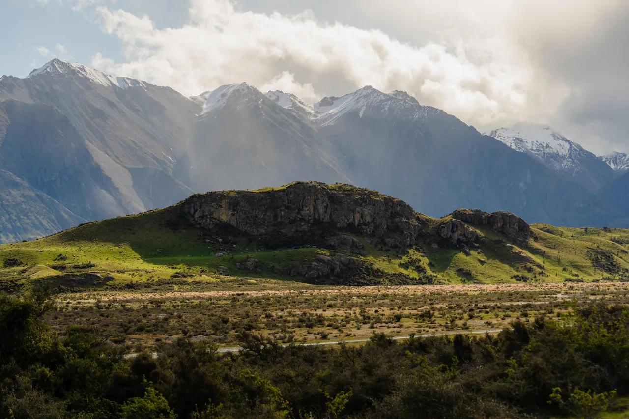
Alpine passes, podocarp forest and the foot of Aoraki/Mount Cook. Combine them with our Mount Cook and Mackenzie page and the Christchurch and Canterbury guide. Heavy snow can hit alpine areas in winter, so come prepared.
87. Lake Taylor
Camp beside the lake and explore the highly scenic area on foot or by mountain bike. Bring a kayak. From SH7 at Waikari, follow the road to Hawarden and join Lake Sumner Road for roughly 50 km. Rough gravel.
88. Avalanche Creek Shelter
A small campsite in Arthur’s Pass village on SH73, ideal for exploring the national park. Alpine weather changes quickly above the bushline.
89. Craigieburn
Beech forest, tussock and rugged mountains, with mountain biking nearby. Turn off SH73 at the signpost between Castle Hill Village and Lake Pearson. Gravel.
90. Wooded Gully (Mt Thomas)
Camp beside a stream, below tracks leading up Mt Thomas, about 12 km from Ashley Gorge. Reach it from Rangiora or Oxford via Birch Hill Road and Hayland Road. Gravel.
91. White Horse Hill
Camp beneath magnificent alpine scenery, 2.5 km from Aoraki/Mount Cook Village at the end of Hooker Valley Road off SH80. Sealed. DOC’s map mentioned a dump station in summer.
92. Peel Forest
A remnant of the podocarp forest that once covered this area, with four cabins on site. Find it 22 km north of Geraldine; the road is sealed. DOC’s map said booking was required from December to March.
93. Orari Gorge
Explore a remnant of podocarp forest along the old bush tramway walk. It’s 13 km northwest of Geraldine via Tripp Settlement Road and Yates Road. Gravel.
94. Waihi Gorge
On the banks of the Waihi River, surrounded by kahikatea, mataī and lowland tōtara forest. It sits 14 km northwest of Geraldine via Woodbury Road and Waihi Gorge Road. Gravel.
95. Pioneer Park
Short walks start nearby, and you can visit the remains of Burkes Cottage. From Geraldine, follow SH79 for 23 km, then Gudex Road and Middle Valley Road. Gravel.
96. Mt Nimrod
A quiet campsite on the eastern flank of the Hunter Hills, with a 3.5 km forest walk to a podocarp remnant. The route from Timaru winds through Pareora Gorge Road and Back Line Road. Gravel.
97. Otaio Gorge
Camp in a scenic reserve beside forest and swim in the river. From St Andrews, follow Blue Cliffs Road for 19.5 km, then Back Line Road. Sealed and gravel.
DOC Campsites in Otago

From the Haast Pass to the Catlins coast. Match these to the Wanaka, Queenstown and Dunedin and Otago activity pages.
98. Pleasant Flat
Take in magnificent views of Mt Hooker and fish the nearby Haast River. It’s beside SH6, 45 km east of Haast. Gravel.
99. Cameron Flat
Camp near the Makarora River, with hunting, tramping or fishing close by. It’s beside SH6, 15 minutes north of Makarora. Gravel.
100. Boundary Creek Reserve
Relax on the shores of Lake Wanaka at this easily accessible campsite, beside SH6 at the head of the lake. Gravel.
101. Kidds Bush Reserve
A large, grassy lakeside camp on the shore of Lake Hāwea, shaded by mountain beech. Take Meads Road, 32 km north of Wanaka off SH6, and expect 6 km of gravel. DOC’s map said there’s no tap water in winter.
102. Moke Lake
A peaceful camp beside a small lake with boating, swimming, fishing and canoeing. Turn off the Glenorchy Road 6 km west of Queenstown, then drive another 7 km up Moke Lake Road, with 4 km of gravel.
103. Twelve Mile Delta
Camp on a river delta near the shores of Lake Wakatipu, 12 km west of Queenstown on the Glenorchy Road. It’s big. The road is sealed to the delta, then narrow gravel tracks wind around the sites.
104. Kinloch
Camp on the shores of Lake Wakatipu, New Zealand’s longest lake, and explore the hiking tracks nearby. It’s 27 km from Glenorchy on gravel roads. The nearby Kinloch Lodge manages the campsite for DOC and has a shop, meals and showers.
105. Sylvan
Camp beside the Routeburn River, then walk to Lake Sylvan or day-walk the start of the Routeburn Track. The road turns to gravel from the Dart River bridge. Hiking further means booking Great Walk huts and campsites ahead.
106. Glencoe
A sheltered campsite surrounded by beech and podocarp forest, with a river, walking and hiking nearby. Turn off SH1 at Herbert into Ord Street, then Monk Street and Glencoe Road. Gravel.
107. Trotters Gorge
A quiet family camp in a bush setting, connecting with two riverside tracks. It’s about 3 km south of Moeraki, via Horse Range Road. Sealed. DOC’s map said flooding may close it in winter.
108. Tawanui
An isolated campsite in a clearing beside the river. Walk the five-hour Catlins River Track through silver beech forest. From Owaka, follow Papatowai Highway about 7 km, then Catlins Valley Road and Morris Saddle Road. Narrow gravel.
109. Purakaunui Bay
Camp on the coast near Purakaunui Falls, with a good surf beach to the south and Jacks Blowhole to the north. Follow Purakaunui Falls Road, then Long Point Road, then Purakaunui Bay Road. Narrow gravel.
110. Papatowai
A Catlins coast campsite nestled in the bush, with easy access to the beach and estuary. It’s one of the larger sites on the Catlins stretch, and the road is sealed.
DOC Campsites in Southland
Two campsites, both in farmland and mountain country. Browse the Southland activities page for more.
111. Piano Flat
A riverside campsite in farmland, 23 km north of Waikaia via Piano Flat Road. Simple and quiet.
112. Mavora Lakes
Walk, mountain bike, hike or fish from a campsite surrounded by mountains, beech forest and grasslands. It’s off SH94, 30 km north of Mossburn, at the south end of North Mavora Lake. Thirty kilometres of gravel. DOC’s map said there’s no tap water in winter.
DOC Campsites Along the Milford Road in Fiordland
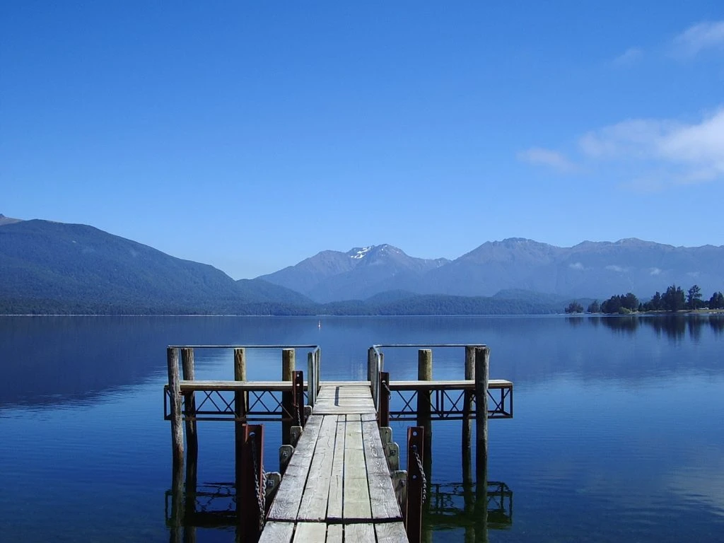
Ten campsites strung along SH94 between Te Anau and Milford Sound, a 119 km, two-hour drive. They’re all gravel and mostly small. Pair them with the Fiordland activities page and our scenic drives guide.
113. Henry Creek
Camp beside picturesque Lake Te Anau, 25 km from Te Anau. There are small private sites in regenerating beech forest.
114. Walker Creek
A tiny campsite beside the Eglinton River, 49 km from Te Anau.
115. Totara
Sites sheltered by lush beech forest, 53 km from Te Anau and south of the Mirror Lakes. It’s suitable for larger vehicles, which makes it a useful pick for motorhomes.
116. Mackay Creek
A quiet campsite with views over the Eglinton Valley, fly fishing in the river and short walks. It’s 53 km from Te Anau.
117. Deer Flat
Camp beside the Eglinton River in an open area near pockets of beech forest, 62 km from Te Anau. DOC’s map said it’s not suitable for larger vehicles.
118. Kiosk Creek
A small campsite with spectacular views of glacial moraine deposits, at Knobs Flat, 65 km from Te Anau. There’s no drinking water, so bring your own.
119. Smithy Creek
A small camping area between Knobs Flat and Lake Gunn, 67 km from Te Anau. Not suitable for larger vehicles.
120. Upper Eglinton
A small camping area near walking and hiking tracks, with magnificent valley views, 71 km from Te Anau. Not suitable for larger vehicles.
121. Cascade Creek
A good camp for larger vehicles at the end of Lake Gunn, with river fly fishing and the Lake Gunn nature walk close by.
122. Lake Gunn
The most northern campsite on the Milford Road, 78 km from Te Anau, beside Lake Gunn. Space is limited and it isn’t suitable for large vehicles.
DOC Campsites in New Zealand: Your Questions Answered
How many DOC campsites are there in New Zealand?
DOC runs more than 300 campsites once you count basic and backcountry ones. This guide sticks to the 122 vehicle-accessible campsites on DOC’s campervan maps.
How much does it cost to stay at a DOC campsite?
Serviced campsites charge $25 per adult for an unpowered site. Standard campsites run $10 to $20, basic campsites are free, and infants under five stay free. Check each campsite’s page, because prices vary.
Can you stay at DOC campsites in a motorhome?
Yes, but check the site first. Many roads are gravel, and several campsites aren’t suitable for larger vehicles. Totara and Cascade Creek on the Milford Road are examples that do suit them.
Are dogs allowed at DOC campsites?
Usually not. DOC’s campsite map said dogs aren’t permitted unless the listing shows a dog symbol, mainly to protect native wildlife. Always check before you bring one.
Is freedom camping better than DOC campsites?
They’re different. Freedom camping is free but restricted to permitted areas, and it needs a self-contained vehicle in many places. DOC campsites give you toilets, water and a legal place to stay. Our motorhome holidays page compares the options.
What else can I do near DOC campsites?
Plenty. Many sit beside national parks, Great Walks and lakes. See our national park guide for ideas.
Plan Your DOC Campsite Road Trip With NZ Tourism Tours
You’ve got the campsites. Now you need the route, the vehicle and the dates. Browse our self-drive tours for ready-made itineraries, or ask our team to build a custom trip around the campsites that caught your eye. We’ll help you match the right motorhome to the roads you want to drive.