

Whanganui Journey: Great Walk Canoe Trip Guide
The Whanganui Journey is a Great Walk that you paddle instead of walk. It runs 145 kilometres down the Whanganui River, from Taumarunui to Pipiriki. First you drift through remote forest. Then you camp on the riverbank and sleep a night on a marae. Most people take five days, and a shorter three-day version also exists. This guide covers the route, huts, river safety, culture and booking.
Whanganui Journey at a Glance
| Detail | Information |
| Distance | 145 km, Taumarunui to Pipiriki |
| Short version | 88 km, Whakahoro to Pipiriki |
| Time | 5 days (3 days for the short version) |
| Craft | Canoe or kayak |
| Accommodation | Huts, a bunkroom and many campsites |
| Booking | Required in the Great Walks season |
| Region | Whanganui National Park, Manawatū-Whanganui |
Whanganui Journey Route, Day by Day
DOC suggests a five-day plan. You can also start at Whakahoro and finish in three days.
Days 1 and 2: Taumarunui to Whakahoro (57 km). You launch at Taumarunui. Then the river soon enters forest. Campsites at Ohinepane, Poukaria and Maharanui break the trip. Whakahoro is the last road access point, so it also works as a start for the short version.
Day 3: Whakahoro to John Coull Hut (29 km). The river now runs through steep, bush-covered gorges. Finally, John Coull Hut gives you a bunk and a place to rest.
Day 4: John Coull Hut to Tīeke Kāinga. On the way, tie up at Mangapurua Landing and walk to the Bridge to Nowhere. Then continue downriver to Tīeke Kāinga for the night.
Day 5: Tīeke Kāinga to Pipiriki (about 21 km). The last day is short. First you pass Ngāporo campsite after 12.5 km. Then you reach Pipiriki after another 9 km. Pipiriki is the usual end of the Whanganui Journey.
The Bridge to Nowhere
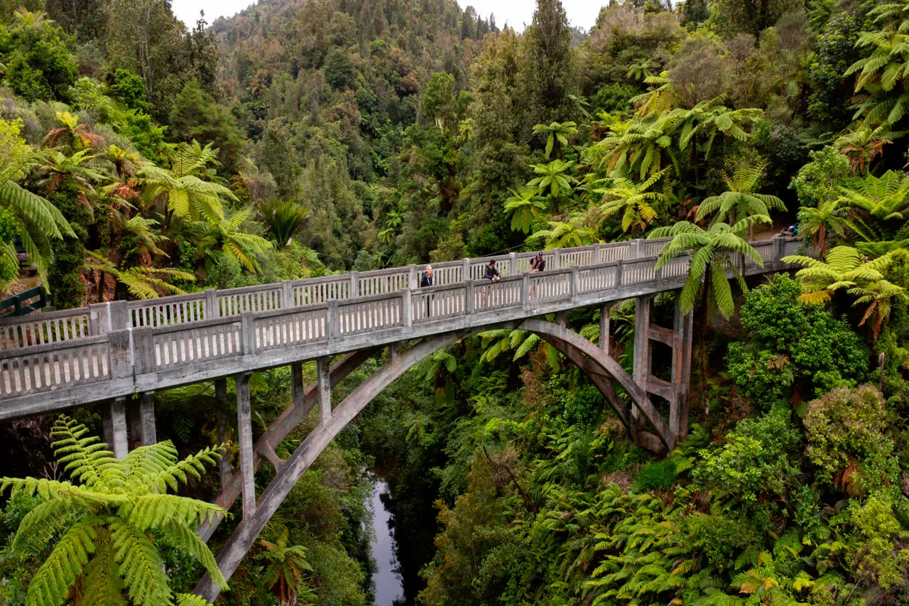
The Bridge to Nowhere is the most famous stop. It stands in the bush as the last remnant of the Mangapurua settlement, which people abandoned in 1942. Paddlers tie up at the landing and walk in. Meanwhile, many other visitors arrive by jet boat from Pipiriki.
Staying at Tīeke Kāinga
A night at Tīeke Kāinga is a highlight of the trip. DOC runs it as a Great Walks hut, and it is also a marae. Te Whānau o Tīeke and DOC manage it together. Visitors are welcome to stay. However, you must follow the guidelines posted there. DOC asks you to keep the grassy marae ātea clear and to respect local protocol.
Also, the river itself has deep meaning. Under a 2017 settlement, the Whanganui River has its own legal identity as Te Awa Tupua. So travel with care, and leave nothing behind.
Rapids, River Levels and Safety
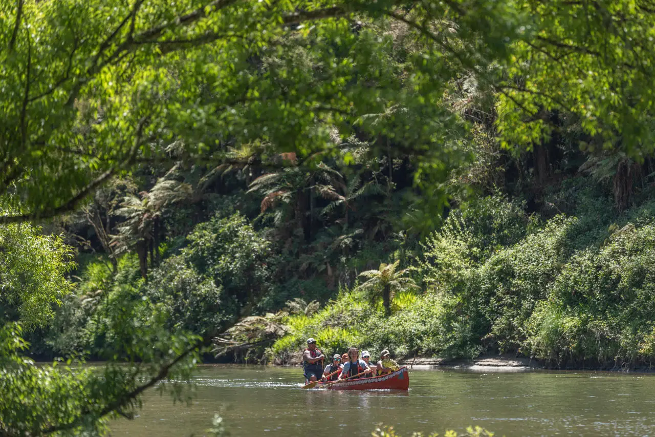
The Whanganui Journey is a gentle river trip. Over 200 rapids lie between Taumarunui and Pipiriki, but most drop less than a metre. However, you still need basic paddling skills and a life jacket.
Follow these rules:
- Check river levels and weather before you launch.
- Also ask your operator about conditions on the day.
- Next, pack gear in waterproof barrels or dry bags.
- Tell someone your plan before you leave.
Rivers rise quickly after heavy rain in this region. So build spare days into your schedule if you can.
Canoe Hire and Transfers
You can bring your own craft. However, most people hire one. Local operators typically rent canoes and kayaks and run transfers to the start and from the end. Because the journey is one way, you need transport at both ends. Book your operator at the same time as your huts.
Our hiking tours page lists guided multi-day options if you prefer a hosted trip.
Huts and Campsites
The route has DOC huts, the Whakahoro Bunkroom and many campsites. John Coull Hut and Tīeke Kāinga are the best known. Campsites include Ohinepane, Whakahoro and Ngāporo. DOC charges fees per person per night. Also, in the Great Walks season, you must book in advance. Outside the season, you cannot book, and spaces are first come, first served.
How to Book the Whanganui Journey
DOC opened 2026/27 bookings for this track on 20 May 2026. It released the Heaphy Track and Lake Waikaremoana Track on the same day. DOC usually announces dates in March, so expect a similar pattern for 2027/28. You can book huts and campsites online, or ask a DOC visitor centre for help. Start with the official DOC Whanganui Journey page.
Best Time to Paddle the Whanganui Journey
The Great Walks season runs from late October to April. Summer brings the warmest weather and long days. However, it also brings the biggest crowds. The shoulder months are quieter but cooler, so pack warm layers. Our best time to visit New Zealand guide helps you choose.
Combine the Paddle with Other Trips
The river lies south of Tongariro National Park, so the two pair well. Read our Tongariro Northern Circuit guide for a volcanic walk. Our Whanganui National Park page covers jet boats and short walks. You can also browse the wider Whanganui and Manawatū activities.
For another North Island Great Walk, see the Lake Waikaremoana Track. In addition, our Māori culture experiences add more local context. To compare every track, use our New Zealand Great Walks overview. Our North Island tours can link them into one trip.
Whanganui Journey FAQs
How long is the Whanganui Journey?
The full journey is 145 km from Taumarunui to Pipiriki and usually takes five days. The short version is 88 km from Whakahoro and takes three days.
Is the Whanganui Journey a walk or a paddle?
It is a paddle. DOC counts it as a Great Walk, but you travel by canoe or kayak.
Do you need experience to paddle it?
You need basic paddling skills. Most rapids are small, but river levels can change fast.
Do you need to book?
Yes, in the Great Walks season. You must book huts and campsites before you go.
What is the Bridge to Nowhere?
It is a concrete bridge in the bush. It marks the abandoned Mangapurua settlement, which closed in 1942.