
Manawatū Scenic Route: A 2-Day Country Road Trip Through the Lower North Island
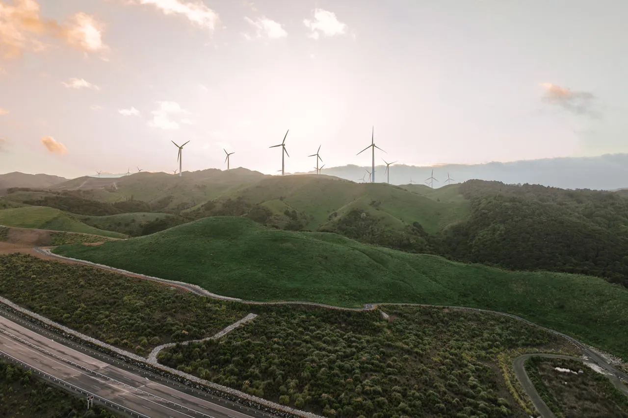
The Manawatū Scenic Route is a slow and peaceful alternative to State Highway 1. It winds for about 115 km from Mangaweka in the north to Ashhurst in the south. On the way it crosses high farmland, drops into the Pohangina Valley and passes ancient native forest at the foot of the Ruahine Range. You will find country pubs, private gardens, swimming holes and even glow-worm caves. The roads are fully sealed and traffic is light. Two days gives you enough time to stop, walk and meet the locals.
What Is the Manawatū Scenic Route?
The Manawatū Scenic Route is a signposted touring road through the back country of Manawatū. Most travellers rush past this region on the main highway. This route takes you away from the trucks and into the quiet farming valleys instead.
The land here has a striking shape. The northern Manawatū is geologically active, and the rivers have carved deep valleys through soft rock. You will see hanging river terraces, steep folded hills and tall white cliffs. Much of the area is sheep and beef country, with patches of old forest left along the rivers and ranges.
It is also one of the best scenic drives near Palmerston North. Ashhurst, at the southern end, is only about 15 minutes from the city. That makes the route easy to add to a trip between Wellington and the central North Island.
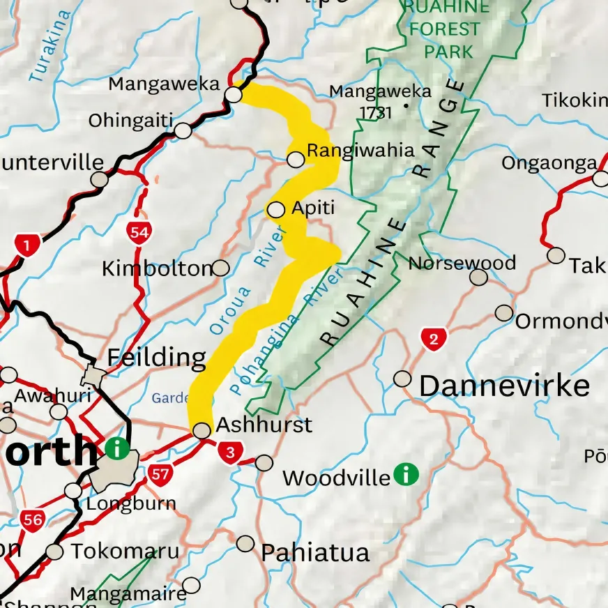
Manawatū Scenic Route Map
Planning Your Manawatū Scenic Route Road Trip
The route is simple to drive, but services are limited. Our guide to driving in New Zealand covers the road rules. Also keep these points in mind:
- Fill up in Mangaweka. There is no fuel between Mangaweka and Ashhurst, a distance of around 115 km.
- Book ahead in Āpiti. The village is small, so accommodation and horse treks need to be booked in advance.
- Pack swimming gear. Several reserves have river swimming spots that are perfect on hot days.
- Bring a torch. You will need one to see the glow-worms near Āpiti.
The road suits cars and campervans or motorhomes alike. Several reserves along the way offer free or low-cost camping.
Day 1: Mangaweka to Āpiti
The first leg covers about 40 km and takes around 45 minutes of driving. However, there are plenty of reasons to stop.
Mangaweka and the Rangitīkei River
Mangaweka is a small village on State Highway 1 between Taihape and Hunterville. It sits above the Rangitīkei River, which has carved huge white papa cliffs into the valley. The best view of these cliffs is from near the Mangaweka bridge. The river is also popular for rafting and kayaking. Grab a coffee, fill the tank and turn off the main highway to begin the route.
Ruahine Dress Circle and Rangiwahia
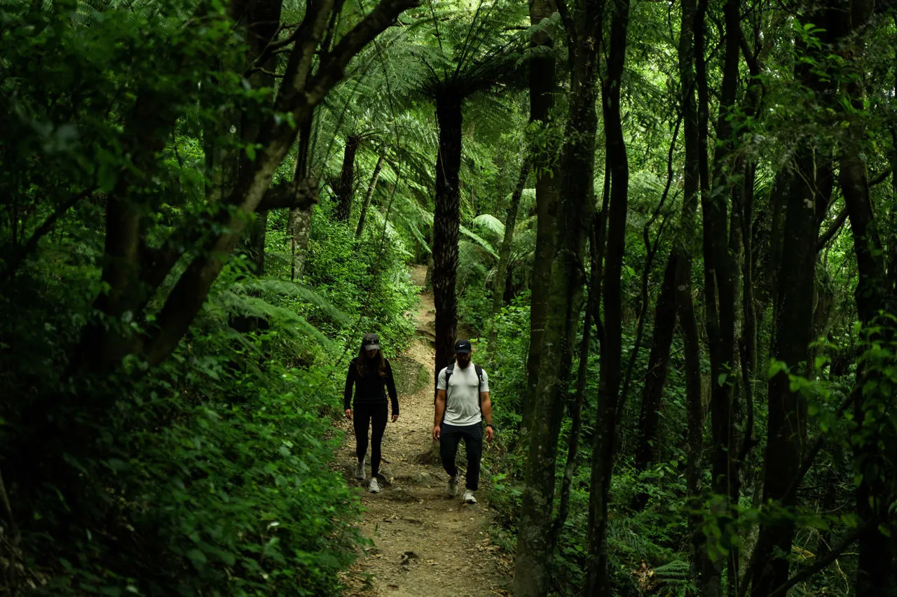
As you climb towards the Ruahine Range, the farmland gives way to patches of native forest. The Ruahine Dress Circle Reserve has waterfalls and swimming holes tucked into the bush. Further on, the Rangiwahia Bush Reserve offers short walks through ancient trees.
Keen hikers can detour along Renfrew Road to the Rangiwahia Hut Track in the Ruahine Forest Park. The track climbs through forest to an alpine hut with wide views on a clear day. Allow a full half day for the return walk.
Mangahuia Wetlands and the Glow-Worm Caves
Closer to Āpiti, stop at the Mangahuia Wetlands. Access is free and the wetland is a quiet spot for birdwatching. Then visit the Limestone Creek Reserve, where small caves glow with tiny lights after dark. The glow-worms are best seen at night, so this stop works well after dinner. Take care on the uneven ground and switch your torch off for a few minutes so your eyes can adjust to the glow.
For something different, Table Flat Trekking runs horse rides across the high country. Pre-booking is essential.
An Evening in Āpiti
Āpiti is a tiny farming village with a big community spirit. The Āpiti Tavern serves hearty country meals and is the social heart of the area. You can camp for free at the Āpiti Domain. Other options include a converted church and a luxury farmstay nearby. Local artists also open their studios to visitors, so ask around if you would like to see their work.
Day 2: Āpiti to Ashhurst
The second leg runs about 57 km and takes around an hour without stops. It follows the Pohangina Valley south towards Ashhurst.
Springvale Gardens and Totara Reserve
Start the day at Springvale Gardens. The rhododendrons here are at their best in October and November. This makes the route a lovely trip if you are visiting New Zealand in spring.
Next, spend some time at Totara Reserve. This large regional park protects some of the oldest native forest in the district. There are bush walks, a campground, barbecue areas and safe swimming spots in the Pohangina River. It is a great place for a picnic with children.
Pohangina Heights and the Valley Gardens
Higher up, Pohangina Heights Gardens sits on a ridge with views that stretch to Kapiti Island on a clear day. If you plan to continue south, our guide to the Kāpiti Coast beaches is a good next stop. Back in the valley, Luttrells White Pine Gardens and Museum is another pleasant place to wander.
Blueberries and Raumai Reserve
In late December and January, call in at Blue Acres Blueberries to pick your own fruit. Then drive five minutes to Raumai Reserve for a cool swim in the river. Public toilets are available at the reserve.
Arrive in Ashhurst
Ashhurst marks the end of the Manawatū Scenic Route. Stop at The Herb Farm for lunch in its café and a walk through the gardens. On weekends, the County Fayre serves coffee and Devonshire teas. Ashhurst Domain also has a campground and seasonal swimming in the Manawatū River. For more places to eat and stay, Palmerston North is only a short drive away.
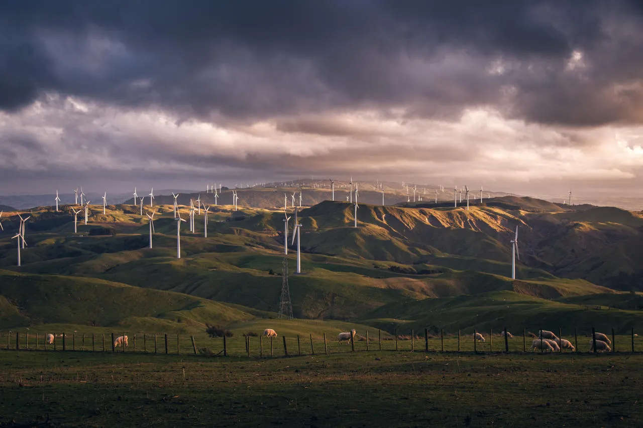
If you still have energy, walk part of the Te Āpiti Manawatū Gorge track. The full track is about 10 km and passes through native bush on the southern side of the gorge. Look out for the Big Slip Lookout and the tall steel sculpture of the chief Whatonga. You can also drive up to the Te Āpiti Wind Farm lookout for views over the turbines and the valleys below.
Things to Do in Manawatū Along the Route
Here is a quick list of the best things to do in Manawatū on this drive:
- See the white papa cliffs at Mangaweka
- Swim in the river at Totara Reserve or Raumai Reserve
- Look for glow-worms at Limestone Creek Reserve
- Hike to Rangiwahia Hut in the Ruahine Range
- Walk the Te Āpiti Manawatū Gorge track
- Pick blueberries in summer
- Visit The Herb Farm and the valley gardens
Best Time to Drive
The Manawatū Scenic Route is open all year. Autumn is a favourite season because the trees in the Pohangina Valley turn gold and red. Read our tips on visiting New Zealand in autumn to plan around the season. Spring brings the gardens into flower, while summer is best for river swimming and blueberry picking. Winter is quieter and can be cold and frosty on the higher roads.
Final Thoughts
The Manawatū Scenic Route shows a side of New Zealand that most visitors never see. There are no big crowds or famous landmarks here. Instead you get quiet valleys, old forest, friendly pubs and warm country hospitality. Fill the tank in Mangaweka, pack a swimsuit and a torch, and take your time. This short road trip is a perfect break on any North Island self-drive tour
Frequently Asked Questions
How long is the Manawatū Scenic Route?
The route is about 115 km long. Driving it straight through takes around two hours, but most people spread it over two days.
Where does the Manawatū Scenic Route start and end?
It starts at Mangaweka on State Highway 1 and ends at Ashhurst, about 15 minutes from Palmerston North. You can drive it in either direction.
Is there fuel on the Manawatū Scenic Route?
No. There is no petrol station between Mangaweka and Ashhurst, so fill your tank before you start.
Is the Manawatū Scenic Route sealed?
Yes. All of the main route is sealed, so it is suitable for cars, campervans and motorhomes.
Where can you camp on the Manawatū Scenic Route?
Free camping is available at the Āpiti Domain. Totara Reserve and Ashhurst Domain also have campgrounds.
Can you cycle the Manawatū Scenic Route?
Yes. The route is popular with cyclists, but it has steep climbs and long gaps between services. It suits riders with good fitness and some touring experience.