
Wharariki Beach: New Zealand’s Wildest Corner
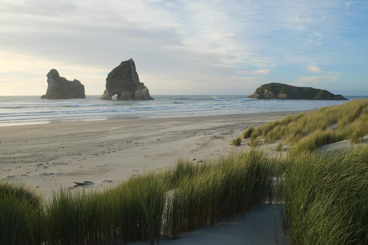
At the very top of the South Island, past the last sealed road and across a stretch of farmland, sits one of New Zealand’s most photographed and least visited beaches. Wharariki Beach has no café, no lifeguard, and no car park within sight of the sand. What it does have are four towering sea stacks known as the Archway Islands, along with a resident colony of fur seals. It also carries a reputation for having once been one of the most famous computer wallpapers in the world.
This guide covers how to reach the beach and what makes it worth the walk. It also explains how the beach fits into a wider Golden Bay trip.
Table of Contents
- Wharariki Beach: Overview & Quick Facts
- The Archway Islands & Wharariki Beach Cave
- The Wharariki Beach Walk
- Cape Farewell & Farewell Spit
- Golden Bay New Zealand & Collingwood
- Planning Your Trip
Wharariki Beach: Overview & Quick Facts
Quick Facts
- Location: western tip of Golden Bay, roughly 30 minutes by gravel road from Collingwood
- Access: a 20-minute walk from the car park; no vehicle access to the beach itself
- Signature feature: the Archway Islands, four rock stacks visible from the sand
- Wildlife: a year-round fur seal colony, best seen at low tide
- Facilities: none; the nearest amenities are back in Collingwood or at the beach’s small campground
Wharariki Beach: An Introduction
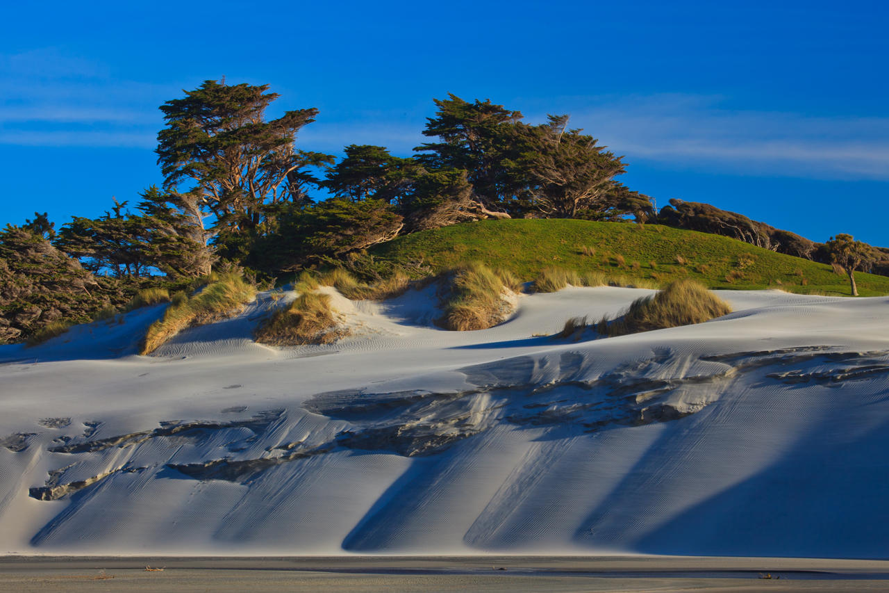
Wharariki Beach sits just west of Cape Farewell, the northernmost point of the South Island. A 3-kilometre arc of sand stretches between two headlands, backed by dunes and framed by the Tasman Sea. Cliffs at either end form a natural amphitheatre. Broad sandflats connect the two sides of the beach even at high tide.
A few details capture what makes this stretch of coast so different from New Zealand’s more developed beaches:
- No development sits anywhere near the beach itself, aside from a small campground along the access road
- The beach appears on Wikipedia’s Tasman District coastline listings as one of the region’s most remote accessible beaches
- Wharariki was reportedly once one of the most widely distributed Windows desktop wallpapers, introducing millions of people to its scenery long before they knew its name
The beach sits at the very edge of the country. Because of this, it rewards travelers willing to commit a full day rather than a quick stop.
The Archway Islands & Wharariki Beach Cave
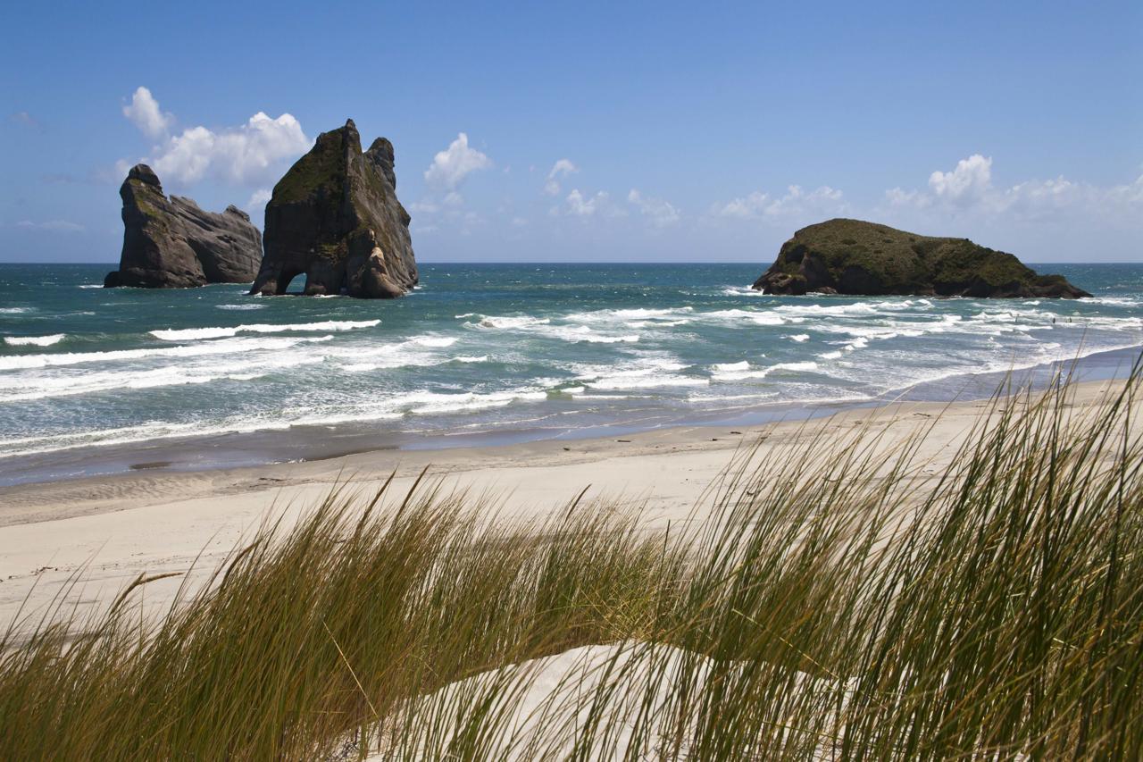
Archway Islands: The Beach’s Defining Landmark
The Archway Islands rise from the surf just off Wharariki Beach, and they’re the reason most visitors make the trip. Technically a group of four rock stacks, the formations include natural stone arches carved by centuries of wave action.
A few facts help visitors get the most out of viewing them:
- The islands look different depending on where you stand on the beach; from the western end, two arches can appear as one
- A third, smaller arch is only visible from the far western section of the sand
- Sunset is considered the best time to photograph the islands, when the low light catches the rock formations directly
- The islands sit within Golden Bay / Mohua, part of the Tasman District’s protected coastline
Wharariki Beach Cave: Exploring at Low Tide
Beyond the Archway Islands themselves, a Wharariki Beach cave near the western end offers a framed view straight through to the islands beyond. Low tide is essential for exploring this area properly. The caves and surrounding rock pools become difficult or impossible to access as the water rises.
Tidal timing matters so much here. Checking tide charts before setting out is one of the most important parts of planning a Wharariki visit, more so than at most other New Zealand beaches.
The Wharariki Beach Walk
The standard Wharariki Beach walk begins at the car park at the end of Wharariki Road, roughly 30 minutes by gravel road from Collingwood. From there, a track crosses farmland and coastal scrub before reaching the sand.
A few practical details make the walk easier to plan for:
- The walk takes about 20 minutes each way at a relaxed pace
- The path passes through a working farm, so gates and grazing stock are a normal part of the route
- No shade exists along most of the track, so sun protection matters even on an overcast day
- Longer options exist too, including a hilltop track connecting Wharariki to Cape Farewell in around 90 minutes
There’s no vehicle access to the beach itself. Because of this, the walk is unavoidable and forms part of the experience rather than an inconvenience.
Cape Farewell: The South Island’s Northern Tip
Cape Farewell marks the northernmost point of the South Island, sitting just a short walk from Wharariki Beach itself. Captain James Cook named the headland in 1770, on his final sighting of New Zealand before departing for Australia.
The cape’s own dramatic cliffs and a smaller natural arch make it a worthwhile stop in its own right. Several walking tracks connect it directly to both Wharariki Beach and Farewell Spit further east.
Farewell Spit: New Zealand’s Longest Sand Spit
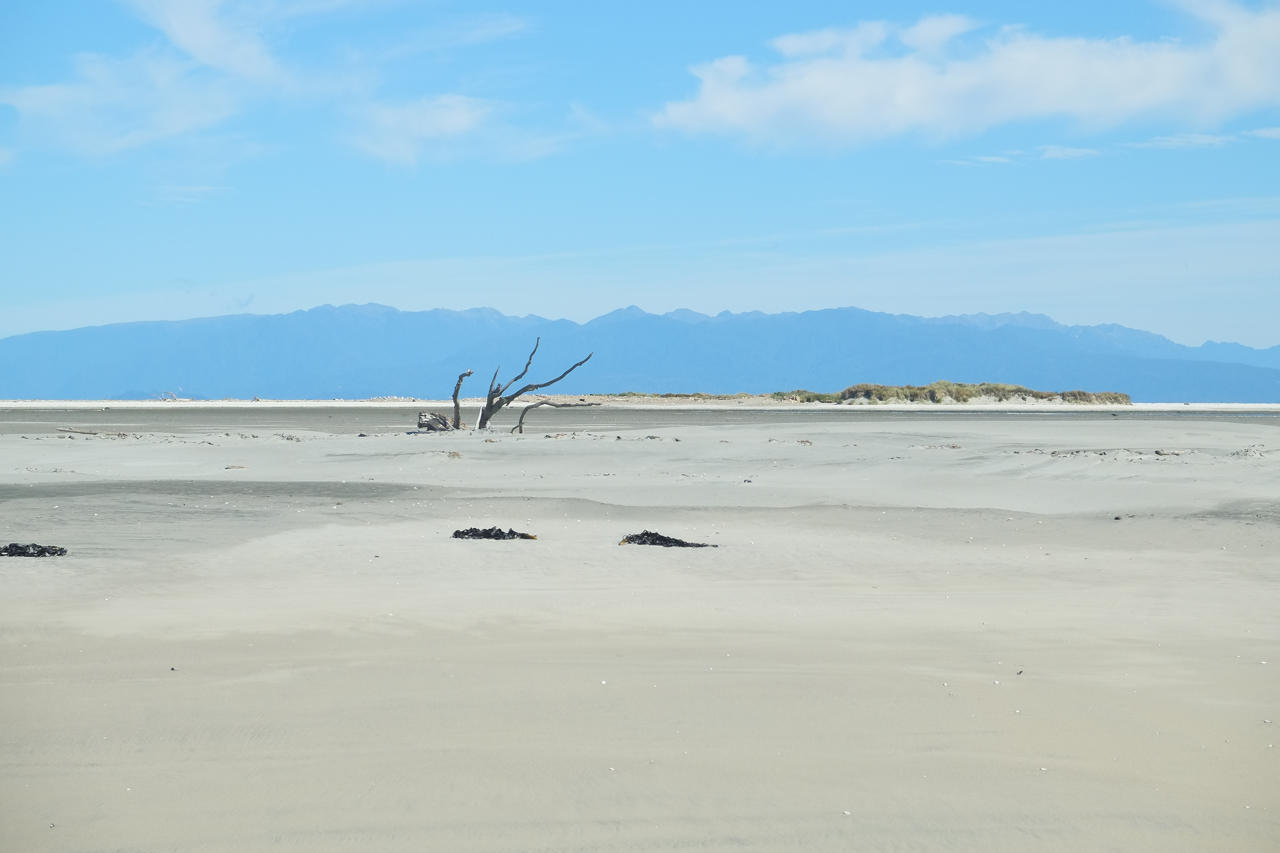
Farewell Spit extends roughly 35 kilometres east from Cape Farewell, making it the longest sand spit in New Zealand. The reserve holds Ramsar wetland status. It functions as a critical stopover for migratory shorebirds travelling the East Asian–Australasian Flyway.
A few facts distinguish Farewell Spit from Wharariki Beach itself:
- Most of the spit is closed to independent visitors and only accessible via organised tours
- The reserve is managed by the Department of Conservation as a dedicated wildlife sanctuary
- Ongoing conservation work aims to remove introduced predators from the spit entirely
Our Farewell Spit Eco Tour departs from Collingwood and covers the full length of the protected reserve, combining wildlife spotting with the area’s shipwreck history.
Golden Bay New Zealand: The Wider Region
Golden Bay New Zealand sits on the far side of Takaka Hill from the rest of the Nelson Tasman region, and that geographic separation gives it a genuinely different character. Small towns here mix quirky cafés and craft shops. The pace is slower than much of the rest of the South Island.
Our Golden Bay tours guide rounds up the wider region. It includes Te Waikoropupu Springs, considered among the clearest freshwater springs in the world.
Collingwood New Zealand: The Last Stop Before Wharariki
Collingwood New Zealand serves as the practical gateway to Wharariki Beach and Farewell Spit alike. With a population of just over 300, this small village once served as a gold rush town. It later became an ecotourism base for travelers heading further north.
Collingwood sits at the end of the sealed road. Because of this, it’s the last place to fuel up, eat, or restock before the gravel road out to Wharariki begins.
Planning Your Trip
Comparing the Area’s Main Sites
| Site | Access | Best For |
| Wharariki Beach | 20-minute walk from car park | Archway Islands, sea caves, seals, sunset photography |
| Cape Farewell | Short walk from Wharariki access road | Cliff views, the South Island’s northernmost point |
| Farewell Spit | Guided tour only | Migratory birds, shipwreck history, the full 35km spit |
| Collingwood | By road | Fuel, food, and the last services before Wharariki |
Getting There
Wharariki Beach sits so far from any major city that it works best as part of a dedicated Golden Bay itinerary, rather than a rushed day trip. Our Abel Tasman National Park guide and Abel Tasman Scenic Cruise cover the neighbouring national park. Both are useful for travelers combining both destinations. A South Island tour package can weave Golden Bay into a longer South Island route. Alternatively, our customizable New Zealand vacation packages can shape a trip entirely around your own interests. You can also add Wharariki Beach directly to your custom vacation package wishlist.
If you’re weighing up other New Zealand beaches alongside Wharariki, our best beaches in New Zealand guide and recent top New Zealand beaches roundup both feature it among their standout South Island picks.
When to Visit
Conditions at Wharariki shift with both season and tide:
- Summer (December-February): the warmest weather and easiest walking conditions, though still genuinely quiet compared to most New Zealand beaches
- Autumn and spring: cooler temperatures and fewer visitors, with clear light often favouring photography
- Winter (June-August): cold and exposed, though the seal colony remains active year-round
Checking tide times before visiting matters more here than almost anywhere else on this list, regardless of season, since the caves and rock pools depend entirely on low tide to explore safely.
Most visitors who make the walk out to Wharariki Beach come away struggling to describe it to people back home. Photos rarely capture the scale of the Archway Islands or the total absence of anyone else on the sand. That remoteness, once purely a logistical challenge, has become the beach’s biggest draw.
You might be chasing the Archway Islands at sunset, a Wharariki Beach cave at low tide, or simply the walk itself across open farmland to reach the sea. Either way, this corner of Golden Bay remains one of New Zealand’s genuinely wild places.
Browse our Golden Bay tours or get in touch to start planning a trip built around Wharariki Beach and the wider Golden Bay region.