Truman Track: Paparoa’s Best-Kept 30-Minute Coastal Walk
Truman Track: The 30-Minute West Coast Walk That Earns a Lifetime of Memories
Most people drive straight past it. The sign on State Highway 6 is easy to miss. The car park is small. The name Truman Track offers no clue as to what lies at the end. What waits, as it turns out, is one of the most complete short walks in New Zealand: a subtropical forest, sea cliffs, a blowhole, a waterfall falling directly onto a hidden gravel beach, and the full, unfiltered drama of the Tasman Sea. All of it within 1.4 kilometres return. All of it within 30 minutes. The Truman Track is the West Coast in miniature, and it is thoroughly unmissable.
Why the Truman Track Punches So Far Above Its Size
The Truman Track sits 3 kilometres north of Punakaiki in Paparoa National Park. It packs more variety into its short length than most walks three times as long. The secret lies in the geography. The West Coast’s narrow coastal strip compresses rainforest, limestone cliffs, and raw ocean into a remarkably tight space. The Truman Track cuts straight through that compression.
In under a kilometre, the environment changes completely. You begin in dense, subtropical coastal forest. You end on a cliff above the Tasman Sea. Between those two points, the track delivers a waterfall, a viewing platform, rock overhangs, a blowhole, and a staircase to a hidden beach. The Truman Track does not require your entire day. It asks for thirty minutes. It gives back far more than that.
Into the Forest: The Walk Begins
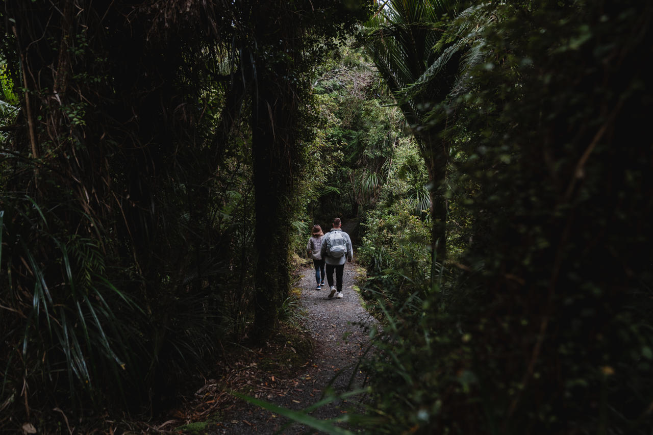
The Truman Track begins on the inland side of SH6, through a clearly marked gate. From the first step, the vegetation pulls you in. Tall podocarps and rātā rise above a dense understorey of nīkau palms, ferns, and vines. The nīkau is New Zealand’s only native palm. Here it grows in clusters thick enough to feel distinctly tropical, a reminder that the West Coast sits at a latitude where subtropical species thrive alongside temperate ones.
The forest floor is dark and cool. The canopy absorbs most of the light and sound. After the noise of the highway, the quiet drops almost immediately.
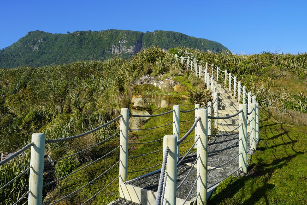
The path is well-formed and easy to follow throughout. It runs slightly downhill toward the coast. The walk to the cliff takes around fifteen minutes at a comfortable pace.
The Coastal Reveal
The forest ends suddenly. The track emerges onto a viewing platform above the sea, and the change is immediate and dramatic. The Tasman Sea fills the entire horizon. Below the platform, limestone cliffs drop sharply to the waterline. Rock overhangs extend over the water. The blowhole, a narrow channel carved into the cliff base, sends white spray upward when the swell pushes in from the west.
To the right of the platform, a waterfall drops directly onto the beach below. It falls clean from the cliff face, hitting the dark gravel without obstacle. This is the image most often associated with the Truman Track. It looks improbable in photographs. In person, it looks like something from another planet entirely.
The platform offers the widest view of the coastal geometry. Spend time here before descending. The view shifts considerably with the light and the tide.
The Hidden Beach
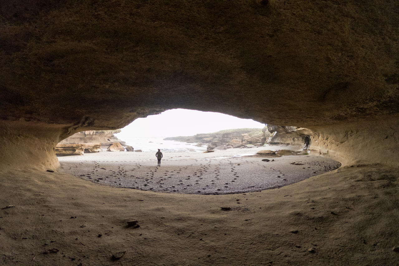
A staircase leads down to the beach below. Take care, the steps can be wet and slippery in sea spray. The beach is a narrow strip of dark gravel and shells, bounded by cliff on both sides. At low tide, explore along the cliff base past rock pools and limestone formations.
At high tide, the beach disappears almost completely. The timing of your visit matters more on the Truman Track than on almost any other short walk in New Zealand. Check the tide tables before you go. The DOC website and most visitor centres in Punakaiki publish them.
The sea here carries serious force. Rogue waves occur without warning, even on calm days. Keep well back from the waterline at all times. The currents make this beach entirely unsuitable for swimming. The Truman Track rewards careful observers.
Pairing With Punakaiki: Two Reasons to Stop
Most visitors combine the Truman Track with the Punakaiki Pancake Rocks and Blowholes, 3 kilometres to the south. These two walks sit far apart in atmosphere. The Pancake Rocks circuit is open, sculptural, and surreal; the Truman Track is enclosed, organic, and intimate, yet they complement each other perfectly. Together, they take around 90 minutes and show two completely different faces of Punakaiki’s extraordinary coastline.
Our Paparoa National Park visitor guide covers the full range of experiences in the park, including the Pororari River Track, the Paparoa Track Great Walk, and the best wildlife viewing spots.
Getting There
The Truman Track car park sits on SH6, 3 kilometres north of Punakaiki. Cross the highway carefully the speed limit is 100 km/h. The small car park fills quickly in summer. An alternative car park 600 metres south provides overflow parking with a 10-minute walk back to the trailhead. You can also walk or cycle from Punakaiki village along the sealed Coast Road.
Before You Go: Essential Practical Notes
Tide timing matters. Visit at or near low tide to access the beach below the viewpoint. High tide covers the beach entirely. Check tables at the Punakaiki Visitor Centre or the DOC website before leaving.
Respect the sea. Rogue waves strike even on calm days. Stay back from the water’s edge on the beach. Never turn your back on the Tasman.
Weather can change quickly. Pack a light waterproof layer regardless of the morning forecast. The West Coast averages over 5 metres of rainfall a year and earns every millimetre.
Leave dogs at home. Dogs are not permitted on the Truman Track at any time. The track requires no permit or booking. It is free.
Making the Truman Track Part of a West Coast Journey
The Truman Track sits naturally on the route between Greymouth and Westport. Most West Coast itineraries pass Punakaiki anyway. Stopping for thirty minutes adds almost nothing to a driving day and adds something genuinely exceptional to the overall trip.
Pair the track with the West Coast Wilderness Trail for a cycling counterpart later on the same itinerary. Or extend south toward Franz Josef and Fox Glacier through our West Coast tours and activities page. For a broader South Island adventure, our South Island tours page outlines itineraries that combine the West Coast with Queenstown, Fiordland, and beyond.
The Truman Track: Thirty Minutes. Lasting Impression.
The Truman Track does not try to compete with New Zealand’s Great Walks. It does not need to. In half an hour, it takes you through subtropical forest, over the edge of a sea cliff, and down a staircase to a hidden beach where a waterfall hits the gravel and the Tasman does as it pleases. It is short, free, and completely unforgettable. Pull over. Cross the road carefully. Walk in. The West Coast, at its most concentrated, waits on the other side.
Ready to explore Paparoa and the wider West Coast? Browse our West Coast tours and activities and start building your New Zealand itinerary today.
Frequently Asked Questions
Q: How long does the Truman Track take?
The Truman Track takes around 30 minutes return at a comfortable walking pace. The track is 1.4 kilometres in total. Most walkers spend additional time at the viewing platform and on the beach below, so budget 45 to 60 minutes in total to properly enjoy everything the track has to offer at low tide.
Q: Is the Truman Track suitable for children?
Yes. The Truman Track is easy and well-formed throughout, making it suitable for children who can manage uneven ground. The main caution is the staircase down to the beach, which can be slippery in wet conditions, and the beach itself, where rogue waves and strong currents make swimming and playing at the water’s edge genuinely dangerous. Supervise children closely near the shoreline.
Q: What is the best time to walk the Truman Track?
Low tide is the best time to walk the Truman Track. At low tide, the beach below the viewing platform opens up for exploration, revealing rock pools, limestone formations, and the base of the cliffs. At high tide, the sea covers the beach almost entirely, and access to the lower area is closed. Check tide tables at the Punakaiki Visitor Centre before setting out.