
Great Alpine Highway: Coast to Coast Across the Southern Alps in a Day — 255 km from Christchurch to Kumara
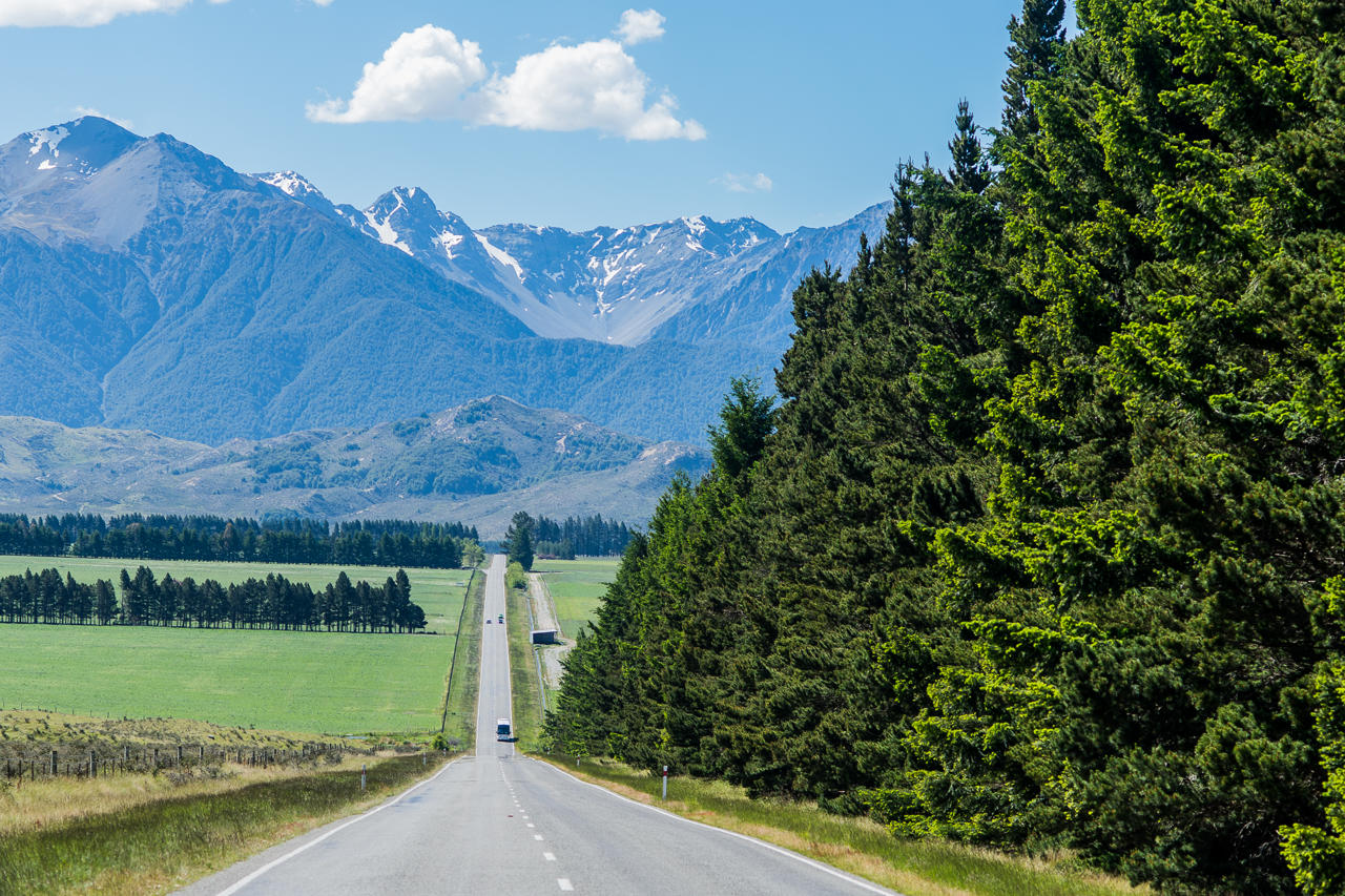
Few journeys pack as much change into a single day as the Great Alpine Highway. You leave Christchurch among flat green farmland on the east coast. A few hours later you are in the rainforest of the West Coast, with the Tasman Sea crashing on the beach. In between, the road climbs over two high mountain passes, winds past giant limestone boulders and crosses one of the most impressive viaducts in New Zealand.
There are two classic ways to make this crossing. You can drive it yourself on State Highway 73, or you can sit back on the famous TranzAlpine train. This guide follows the road from coast to coast, then compares the two options so you can choose the one that suits you best.
What Is the Great Alpine Highway?
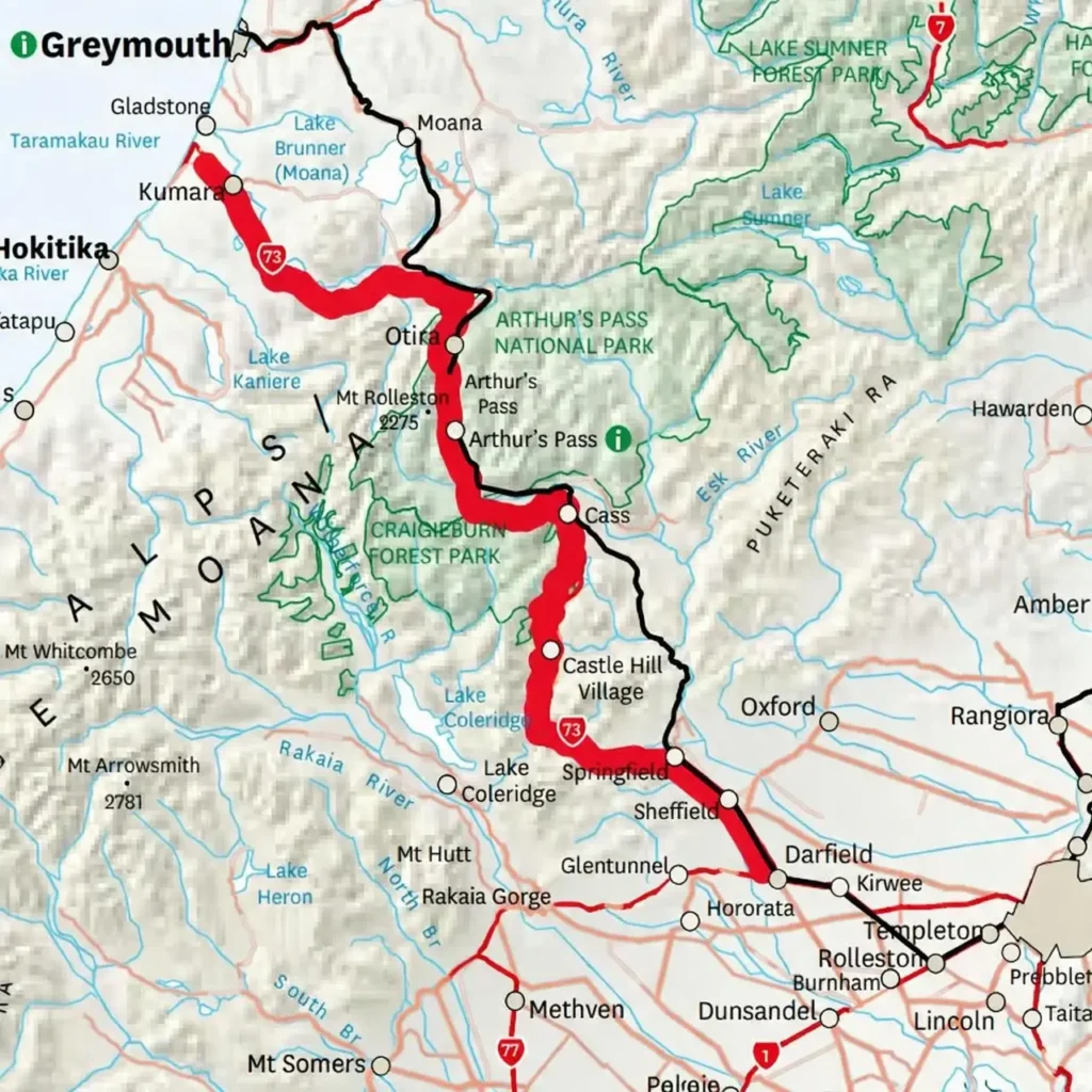
The Great Alpine Highway is the touring name for State Highway 73. The route runs for about 255 km from Christchurch to Kumara on the West Coast, where it meets the coastal highway near Greymouth and Hokitika. It is the most direct road link between Christchurch and the West Coast, and it runs right through Arthur’s Pass National Park.
The highway reaches its highest point at Porters Pass, at 939 m above sea level. Arthur’s Pass, further west, sits at 920 m. Between these two passes you cross some of the wildest alpine country that you can reach by car in New Zealand.
Driving straight through takes around three and a half hours. However, most people stop so often that the crossing becomes a full day. That is exactly how it should be.
Great Alpine Highway Map
Driving the Great Alpine Highway From East to West
Leaving the Canterbury Plains
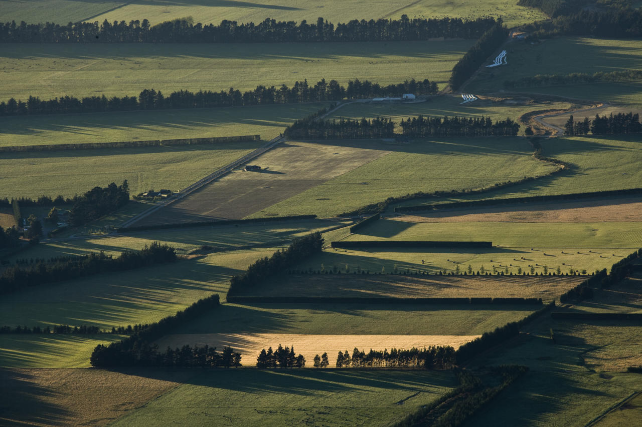
Start early in Christchurch and head west across the Canterbury Plains. If you need ideas for the city before you leave, see our Christchurch and Canterbury activities page.
Your first quirky stop is Springfield, a small town at the foot of the hills. It is known for a giant pink doughnut sculpture beside the road. The doughnut was first put up to promote The Simpsons Movie in 2007, and it has become a much-loved roadside photo spot.
Porters Pass and Castle Hill
Beyond Springfield, the road climbs steeply to Porters Pass. In winter, the slopes here become small club ski fields, and the views back over the plains are huge. On the other side, the landscape changes completely.
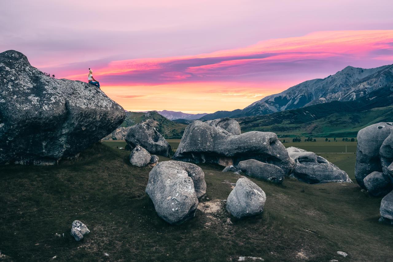
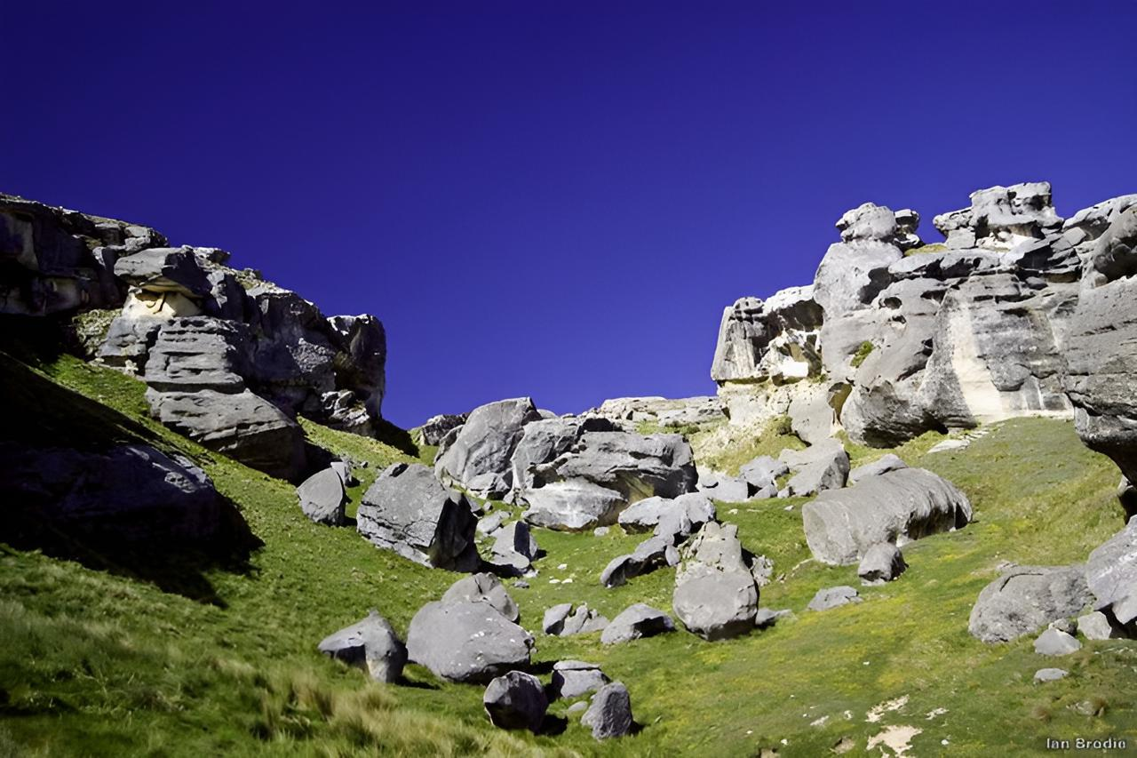
Castle Hill, known in Māori as Kura Tāwhiti, is one of the most unusual places on the route. Hundreds of grey limestone boulders rise out of the tussock like the ruins of an ancient city. Easy paths wind between the rocks, and rock climbers come from around the world to try the boulders. Allow at least half an hour to wander.
Cave Stream and Flock Hill
A few minutes further on, Cave Stream Scenic Reserve offers a short adventure for the brave. A stream flows through a cave about 360 m long, and you can walk through it in the water. You will need a torch, warm clothes and sturdy shoes. Never enter after heavy rain, when the water can rise quickly.
Nearby, the rolling hills of Flock Hill Station appeared in The Chronicles of Narnia. Our guide to the Flock Hill Narnia filming location has the full story. The road then follows the shores of Lake Pearson, a calm lake that reflects the mountains on still mornings.
Arthur’s Pass Village and National Park
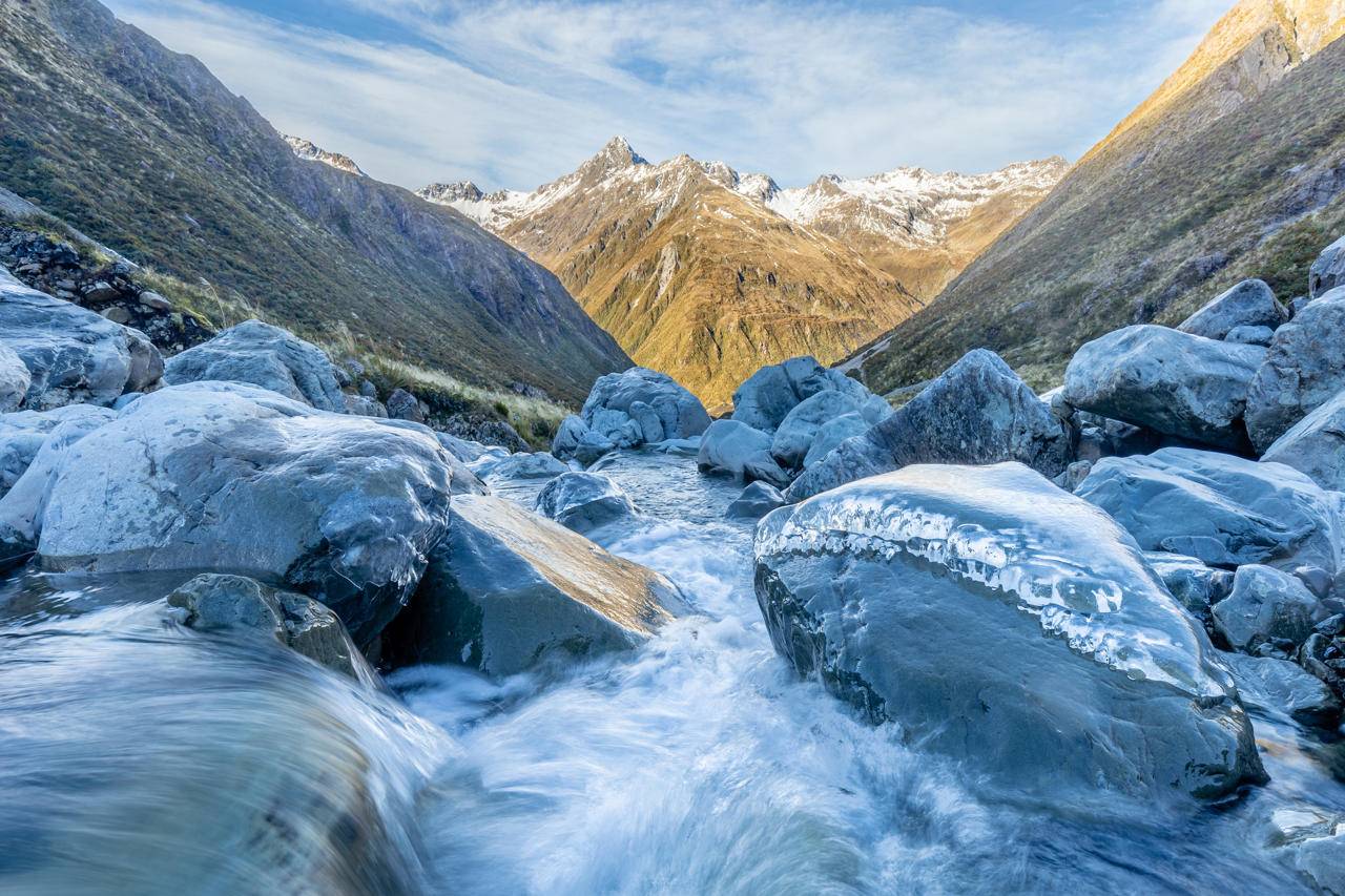
Arthur’s Pass National Park was established in 1929 and was the first national park in the South Island. The small village of Arthur’s Pass sits in the heart of the park and makes a perfect lunch stop.
From the village, the Devils Punchbowl Falls walk takes about an hour return. It climbs through beech forest to a tall waterfall that drops straight down a rock face. Keen hikers can tackle the much harder Avalanche Peak track, which needs a full day and good fitness.
Look out too for kea, the world’s only alpine parrot. These cheeky green birds are clever and curious, and they often hang around car parks. Please do not feed them, as human food is harmful to them. Learn more in our guide to New Zealand birds.
The Otira Viaduct and Death’s Corner
West of the pass, the road drops sharply into the Otira Gorge. For many years this section was one of the most dangerous roads in the country, with slips, rockfalls and tight bends. The Otira Viaduct opened in 1999 to carry the road safely across the gorge.
Stop at the Death’s Corner lookout above the viaduct for the best view. From here you can see the curved concrete span sweeping across the valley below. Kea often visit this car park too.
Down to Kumara and the West Coast
The road then follows the Otira and Taramakau rivers down through lush rainforest. The air feels warmer and wetter, and the bush grows thick with ferns and moss.
The Great Alpine Highway ends at Kumara, an old gold rush town with a historic hotel. Kumara is also the start of the West Coast Wilderness Trail, a popular cycle trail. From here, it is a short drive north to Greymouth or south to Hokitika. If you plan to explore further, see our West Coast activities page or our guide to Hokitika Gorge.
TranzAlpine or Drive: Which Is Better?
The TranzAlpine is one of the best-known train journeys in New Zealand. It runs from Christchurch to Greymouth, a distance of about 224 km, and takes around four and a half hours one way. The train passes through the 8.6 km Otira Tunnel, which opened in 1923, and crosses high steel viaducts above deep river gorges.
The right choice depends on what you want from the day.
Choose the TranzAlpine if
- You want to relax. Someone else handles the mountain roads, and you can enjoy the views from big panoramic windows.
- You prefer a day trip. You can ride across and back in one day, or take the train one way and continue by car.
- You want to avoid winter driving. The train is a calm way to see the snow without worrying about ice.
- You love rail history. The line and its tunnels are an engineering story in their own right.
Choose to drive if
- You want to stop when you like. The car lets you visit Castle Hill, Cave Stream and the walks at Arthur’s Pass.
- You want to see the viaduct. The Otira Viaduct and Death’s Corner are only on the road route.
- You are continuing your trip. Driving gives you a car on the West Coast for the glaciers and the coast road.
- You travel on a budget. For a group or family, driving usually costs less than train tickets.
The Best of Both
Some travellers combine the two. They take the TranzAlpine from Christchurch to Greymouth, then pick up a rental car on the West Coast. Others drive west and take the train back. Check the timetable before you plan, because the train may run on fewer days in winter.
Driving Arthur’s Pass in Winter
Driving Arthur’s Pass in winter is possible, but it needs care and preparation. Snow and ice can affect both Porters Pass and Arthur’s Pass from about May to October. Here are some tips:
- Carry snow chains. Chains may be required on the passes, and you should practise fitting them before you need them.
- Check road conditions. Look at the NZ Transport Agency Waka Kotahi journey planner before you leave.
- Drive in daylight. Black ice is most common early in the morning and late in the evening.
- Allow extra time. Slow vehicles and snow clearing can add delays.
Our guide to driving in New Zealand covers more winter driving advice.
Best Time to Travel the Great Alpine Highway
Each season offers a different crossing. Summer brings long days and the best weather for walks at Arthur’s Pass. Autumn is calm and settled, with clear views and fewer crowds. Winter turns the passes white and brings skiers to the small club fields. Spring can be changeable, but the rivers run high, and the waterfalls are at their best.
Whatever the season, the weather can change quickly in the mountains. The West Coast side is much wetter than the east, so pack a rain jacket even on a sunny day in Christchurch.
Final Thoughts
The Great Alpine Highway is one of the most exciting drives in the South Island. In a single day you travel from farmland to rainforest, past limestone castles, waterfalls, alpine parrots and a famous viaduct. Whether you drive the road or ride the TranzAlpine, the crossing will stay with you long after you reach the coast.
If you are planning a longer trip, add it to a South Island self-drive tour. It is the perfect link between Christchurch and the wild West Coast.
Frequently Asked Questions
How long does it take to drive the Great Alpine Highway?
Driving from Christchurch to Kumara takes around three and a half hours without stops. Most people take a full day to enjoy the main sights.
Is the Arthur’s Pass road dangerous?
The road is steep and winding in places, but it is sealed and well maintained. The Otira Viaduct has made the most dangerous section much safer. Drive carefully, especially in winter.
Do you need snow chains for Arthur’s Pass?
You may need chains in winter. Carry them between May and October and check road conditions before you set off.
Should I take the TranzAlpine or drive?
Take the TranzAlpine if you want to relax and enjoy the views. Drive if you want to stop at Castle Hill, Cave Stream and the Otira Viaduct, or if you are continuing your trip on the West Coast.
Can you see kea at Arthur’s Pass?
Yes. Kea are often seen in Arthur’s Pass village and at the Death’s Corner lookout. Enjoy them from a distance and never feed them.
Can you do the Great Alpine Highway as a day trip?
Yes. Many travellers drive from Christchurch to Arthur’s Pass and back in a day. Crossing to the West Coast and back in one day is possible but makes for a long drive.